|
9/11 Tuesday—San Diego to Bar Harbor
Terry drove us to the airport at 7:00a.m. The plane left right on time at 9:00a.m. for Boston (with a puddle jumper to carry us on to Bangor).
Unfortunately, the remains of Hurricane Henrietta that hit North Carolina screwed up air traffic on the east coast. We were caught in a huge holding pattern circling and circling over Boston. The flight attendant in the back cabin was worried about some 9/11 anniversary related event and phoned American Airlines on the ground. No terrorist – just Mother Nature. We finally landed in Boston a couple of hours late only to learn that our second flight, the puddle jumper to Bangor, was delayed from 7:20 to 9:30 p.m. We grabbed a bite at Killian’s Pub. The service was slow, but we didn’t care.
Our plane to Bangor left at 9:30. Bill sat behind me and found a new pal named Larry – a professor at UCSD and acquaintance with Clint and Terry (our neighbors) – small world. I plugged my ears and read my book Brick Lane – best chick-lit I’ve ever read.
We got into Bangor at 10, collected our luggage and picked up our little white Kia from Alamo. We had a heck of a time navigating out of town – poor signs and the rain didn’t help. We finally found I-395, then 1, then 3 on into Bar Harbor. It was a tense hour’s drive in the dark and rain, but by 11:30 we were at the Acadia Pines Motel room 5, door left opened as promised. (Great motel – clean, quiet and cheep--$58--389 State Highway 3, Bar Harbor, ME 04609). We settled in, happy to be through with airports, imaginary 9/11 events and dark, rainy roads. Lights out at 12:30 a.m.
9/12 - Wednesday (Orientation Day on Mt. Desert Island)
We managed to sleep in until 8:30 – very late for us. We drove into Bar Harbor and had breakfast at “2 Cats” (130 Cottage Street). Fun, funky, colorful Victorian house with a delightful breakfast – good and cheap with a touch of class.
We spent the next hour doing reconnaissance work – investigating bike rentals and checking e-mails at the town library. (Jesup Memorial Library, 34 Mt. Desert St.) I liked the gentle librarian and the dignified historic library building constructed in 1911 for $77,000.
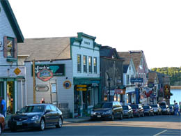
We got stuck in traffic in downtown Bar Harbor – too many tour buses and RV’s and just too many of us old retired geezers not knowing which way to turn. We found a parking space.
The little old ladies in the Chamber of Commerce Information Store didn’t have much to offer – only told us that the Puffins had all left in August.
The weather was blustery and threatening so we drove back to the motel to gather our rain gear – smart move, because as soon as loaded umbrellas and ponchos into the truck, the sun came out immediately. Forecast for clearing and then sunny skies for the next few days.
At 11:30, we finally entered Acadia National Park in Hull’s Cove and found a friendly, helpful Ranger who helped us map out the rest of our day.
First the famous 20-mile Park Loop Road – almost a park requirement. Beautiful drive – We stopped along the way to visit the following sites:
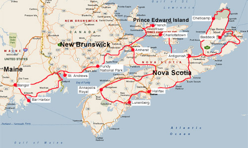
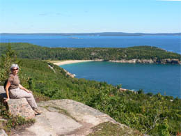
Cadilac Mountain – Overrun with retirees blown around in the wind trying to enjoy the clear views of Bar Harbor down below.
On top of Cadilac Mountain |
Sieur de Monts Spring – a natural spring with a botanical garden divided into 12 habitats (mildly interesting). We passed on the Abbe Indian Museum and did a short loop hike to the “tarn” – debated about what in tarnation the word “tarn” means ("A small mountain lake, especially one formed as a glacier melts, filling a cirque with water"). It was a peaceful hike in the woods until we got to the tarn and saw the traffic zooming by on the other side.
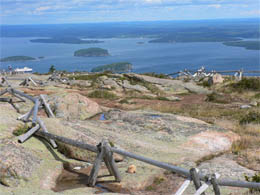
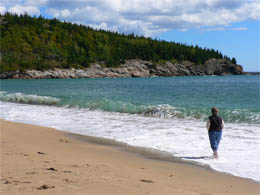
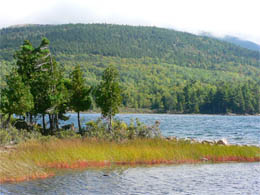
Sand Beach – huge waves, windy, not too impressive (but we are jaded by the beaches in San Diego). A few people were actually jumping around in that cold water. (I immediately thought of the severe shrinkage.)
Sand Beach |
Brrrr … This guy is wearing a knitted hat! |
(We skipped the next two stops on the 20-mile loop trail – Thunder Hole and Otter Point.)
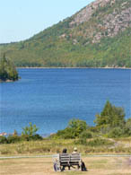
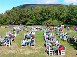
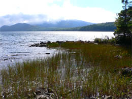
Jordan Pond – At 2:30, we stopped at the place famous for its tea and scones. However, the place was overrun with tour busses, RV’s and rich folks in their big floaty cars all looking for a parking space and a gift shop. The experience put us in a foul mood, so we decided enough of Jordan Pond and the rest of the 20-mile loop trail – We’d head west -- out to the quaint little villages on the “Quiet Side of Mt. Desert Island.”
What a beautiful drive through rolling hills. My eyes distilled only three main colors – emerald green grass, blue skies and bright white puffy clouds. It was wonderful being surrounded by so much beauty.
However, it was on this drive that we became acquainted with “The Bitch” – billed as a GPS navigation system, but really the third traveler, or should I say “third wheel” that tagged along and tried to control our every move. Terry loaned her to us, but she, being a control freak, took over, interrupting us, barking orders “Turn Left, recalculating” as we explored the following towns:
Seal Harbor – wealthy place loaded with yachts. One could cross the harbor by walking from one yacht deck to the next.
Northeast Harbor – another wealthy town with jewelry shops and art galleries galore.
Somesville – a tiny village where the first European settled on Mt. Desert Island. (Abraham Somes sailed up from Gloucester in 1761 to the area, fell in love with the place and then returned the next year with his wife and four daughters.)
Southwest Harbor – Passed on the “The Gilley Duck Decoy Museum” -- the thing one must do in Southwest Harbor. We didn’t want to waste time or money. Instead we stopped at the Visitor’s Center and then the town library (e-mail check) to get our bearings.
It was close to dinner so we drove down to the harbor to Beal’s – famous for its lobster dinners. We picked out our lobsters – got the hard-shelled guys and then went to another counter to order potatoes, corn, cold slaw and beer (total dinner for two of us was $40!) We ate out on a picnic table in the side screened-in porch, making pigs of ourselves ripping into those hard shells. Excellent dinner!
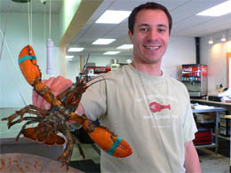
Yum, This guy’s for me! |
We had a few more quiet, quaint towns to explore – Bass Harbor had a very nice lighthouse, but closed by our Homeland Security. We ran out of sunlight and energy in Tremont. We stopped to see the other Lobster Shack called Thurston’s. It was the scene of one of Stephen King’s movies. (We’re glad we had our lobster at Beal’s – cheaper, funkier place to dine.)
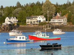
Tremont - Typical Quaint Fishing Village |
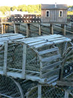
Lobsters traps |
We made the mistake of letting “The Bitch” (Miss GPS) determine our route back to the motel. We hadn’t learned her evil ways. Without entering a full address, there’s no telling what she’d do. She took us back though the 20-mile loop trail, then through crowded downtown Bar Harbor. She had her way with us and we didn’t get back to our motel until after 7 – a very long day of driving for Bill.
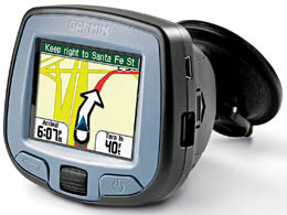
The "Bitch" |
9/13 – Thursday – Bar Harbor and Acadia National Park
We had breakfast at the Log Cabin (338 State Rd 3, Bar Harbor - 207 288-3910) across the road from the motel. The food was like Denny’s, only worse. I had the buffet because it included yogurt and fruit and cereal. Most of the items at the trough were greasy and fatty, like the folks who lined up to stuff it in. One guy ordered 3 breakfasts and a couple of Bloody Mary’s.
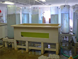
We arrived at the Mount Desert Oceanarium (Route 3, Thomas Bay Harbor) right at opening time (9:00 am). We paid our $10 each and came away with new knowledge and insights into the life of lobsters and lobster fishermen (lobstermen). Well worth the time and money.
First we visited the lobster hatchery. A knowledgeable, somewhat geeky guy showed us through the laboratory. The hatchery’s mission is to hatch lobster eggs, protect the young as they grow and then released them back into Maine’s coastal waters.
Our guide showed us a Lobster with her tail covered in eggs – about 10,000 to 20,000 of them - brought in by a lobsterman. Only about 10 babies survive the first four weeks of life. It takes two years to go from egg to adult and only a couple of eggs out of the 20,000 even make it. The eggs hatch into lobster larvae, which then go through four stages of development. It takes a lobster close to seven years to grow to 1 or 1 ½ pounds and reach the legal minimum size for catching of 3 3/16” (from eye socket to end of back).
Hatchery (Lobster Laboratory) |
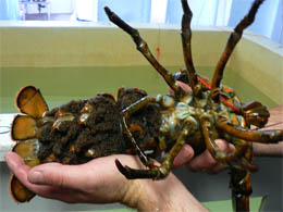
Mama Lobster loaded with eggs |
| The Life Cycle of A Lobster:
August – November – The female molts and is fertilized by the male lobster.
One year later (June – July) – Female pushes the eggs out through two genital openings where they are fertilized. They are held on her abdomen for another nine months before they hatch.
18 to 23 months later (June – July – August) – The eggs hatch (water at 72 degrees; development in 14 – 16 days). The embryo develops into a larva, then goes through 4 stages until it is fully formed.
7 Years later – Lobster is 1 or 1 ½ pounds and ready to be eaten! |
Our guide placed a tiny lobster about the size of a nat under a powerful microscope hooked up to a TV monitor. This little thing had all the details of a lobster.
These aggressive little guys attack each other as soon as they start to develop claws. They are kept in huge tanks of swirling water, churning constantly to keep the lobsters from eating each other. The baby lobsters are fed brine shrimp (A.K.A. Sea Monkeys). When they get bigger, the lobsters are moved into individual containers until they’re ready to be released. Once they’re big enough to make it on their own in the ocean, scientists take them out in a boat and release them through a long hose to the bottom of the ocean. Lobster fishermen go along on this freedom journey to point out the best hiding places for the lobsters. Once in the ocean, they immediately go into hiding – not very social critters at all.
The entire process (hatching to tanks to ocean) is very costly. It’s tough for the Oceanarium to show success rates in only a few years and tough for them to get funding.
We said goodbye to the Lobster Laboratory and then walked to the Lobster Museum. Betty, a crusty ole gal who has been married to a lobsterman for 40 years, told us more about life with lobsters in wonderful plain talk. Her stage was a 28-foot boat with lots of props.
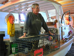
Betty on her “Museum Boat” |
What We Learned from Betty:
She’s married to a lobsterman who comes from three generations of lobstermen and works very hard – 7 days a week, very long hours. He fishes for Beal’s in Southwest Harbor (we may have eaten one his catches the night before).
In the spring he could sell lobster for $3.85 a pound – a very low price. As a result, most lobstermen went on strike. The strike didn’t accomplish anything because now the lobstermen only get $3.50 a pound. To make matters worse, the price of gas and bait have skyrocketed, further cutting into their profits. Mother Nature made it worse with cold weather in the spring – the water didn’t warm up.
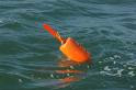
The Lobster trap
Lobster traps have two compartments –
1. The kitchen (with the bait basket to attract the lobster). Lobsters have a very good sense of smell.
2. The bedroom (or parlor) – has a small vent where smaller lobsters can escape. A lot of other things get caught in the lobster traps as well.
| Each trap is tagged and regulated. The traps are attached to buoys (each lobsterman is assigned specific colors for his buoys). |
 |
There are rules that determine whether a lobster can be kept –
- Test of size – must measure 3.25 to 5 inches from eye socket to back.
- Notched tails or mutilated (injured) lobsters are thrown back.
- V-notched tails are marked as breeder and must be thrown back.
Each fisherman is limited to 800 traps. There are usually 500 traps per boat which are set out over two or three days. Normally the lobsterman pulls in 75 traps a day, averaging one pound of lobster per trap.
Lobster Facts:
One claw bigger than the other – The bigger one is a crusher and the smaller one is a cutter / riper (quick). The larger claw, crusher, holds onto the prey while the smaller claw (cutter) is used for tearing and cutting. They can regenerate a claw.
Their powerful tails can propel them at speeds of 30 mph.
Their shell protects them. They go through a molting process to grow a new shell. At the appropriate time, a chemical is released in their body to dissolve the old shell. It takes about 30 minutes to split their old shell and pop out the back. They emerge with just the membrane and go into a hole while the new shell is hardening up. A one or two pound lobster sheds about once a year. The soft shell lobster (the new shell) leaves room for the body to grow so a lot of water is trapped under the shell. (Because you’re getting more water and less meat, soft shell lobsters cost less than hard shell lobsters.)
Lobsters have no brains and a nervous system like a grasshopper. Their stomach is in their head where a brain should be.
The tail of a male lobster is narrower and not as deep as a female lobster tail. |
After Betty filled our heads with lobster facts, we walked through the marsh out back and saw a Great Blue Heron fly to the top of a tree.
We drove to Pepper’s Pizza and Sub (Rte. 3, Hull’s Cove) and got a large sub to go ($6.25); then we stopped back in at the Acadia Park Visitor’s Center to get some hiking suggestions. We talked to the same Ranger from yesterday – only today he wasn’t as enthusiastic.
We drove to the Gorham Mountain Trailhead. There were no parking spaces available in the lot, so we left the car on the road and headed up the mountain. It was only 525 feet high, but we had great ocean views from this ridge trail (including Sand Beach).
Nancy with views of the ocean and Sand Beach |
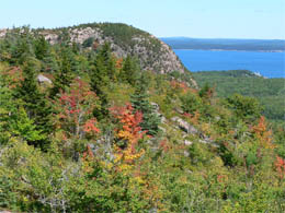
It’s beginning to look like Fall |
The trail was well marked with Cairns. Walden Bates (born in 1856) is credited with a particular type of cairn. A plaque on the trail commemorated him and his clever marking system. There were a lot of people on the trail and we were at the top before we knew it. We ate our sub – very good, but the chocolate chip cookie was sub par, so I gave mine to Bill.
After lunch we continued north, descending down the alleged mountain until we came to the trail for the Beehive (520 feet). The Ranger at the Visitor’s Center told us in clear term NOT TO DO IT, but we headed up anyway. We had a great time. However, as we got higher, there were more and more ladder rungs anchored into the steep rocks. We weren’t worried about going up, but the thought of coming down started to spook us – so we turned back. We joined a crowd of other people watching in horror as a couple of fearless souls descended down the Beehive.
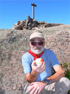
Bill having lunch on top of Gorham Mountain |
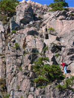
The climb up Beehive |
Next we walked along the classic Maine seacoast with its rugged rocks with waves splashing against the coastline and Sea Gulls overhead and Cormorants diving into the ocean. Several people brought lawn chairs to sit by the ocean to read and relax.
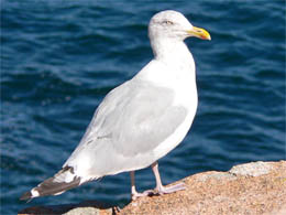
My best shot of a Sea Gull |
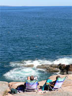 Relaxing by the ocean |
We meet our Ranger, Sierra Coon, at the parking lot for the 3 p.m. guided hike to Otter Point. Her name, Sierra, was given to her by her hippie parents from California. I adored Sierra’s spunky spirit and delightful sense of humor.
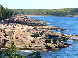 The rugged coastline
|
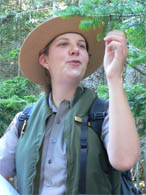
Ranger Sierra telling us about Spruce trees |
There were able 40 or 50 people on the hike. Poor Sierra lost her voice trying to point out all the wonders of nature.
She started our hike with a quote from Rachel Carson. As we looked at the coastline and pounding waves, she read these words:
"For millenniums, the sea's waves have battered the coastlines of the world, here cutting back a cliff, there stripping away tons of sand from a beach, and somewhere else, in a reversal of their destructiveness, building up a bar or a small island. Unlike the geologic changes that take millions of years to bring about the flooding of half a continent, the work of the waves is perceptible during the brief span of human life; the sculpturing of a continent's edge is something we can all see for ourselves." -- Rachel Carson, 1951
A Few Disjointed Facts on Our Guided Hike to Otter Point
The forests in Acadian National Park are a mixture of broadleaf and evergreen trees. The original forests were Spruce and Fir – then came the fire of 1946 that killed all the trees and left no shade. Broadleaf trees happen to like full sun and grew like crazy. They got big and cast great shadows (causing shade to return) so back come Spruce and Fir who flourish in the shade.
You can identify a Spruce tree by plucking a needle. If it sticks you, it’s a Spruce. When you roll it between your finger and spins freely (square needles), it’s a Spruce. (Remember S’s – Spruce -- Stick / Square / Spin)
A Fir tree is friendly (doesn’t poke or stick you). Its needles are flat (can’t spin between your fingers) and it smells like Christmas. (Remember F’s for Fir -- Friendly / Flat / Father Christmas.
We saw a form of Lica called old man’s beard that hung on a few trees like Spanish moss. It only attaches itself to dieing trees.
The Poison Ivy was lovely in its early fall colors – red and healthy. (Remember: Leaves of three, let it be!)
We watched the Eiders bobbing along the coastline. They are duck-like birds that stay in the water 98% of the time. Their legs are simply not designed for walking. Their wings absorb water so they can more easily dive into the ocean. When they need to fly, they have to dry out their wings. The female nests for 24 days – some die nesting.
The sand from Sand Beach is made mostly from finely crushed shells. The cobblestones from Cobble Beach were used to build cobble streets in Philadelphia, Boston, and other towns.
Artists at the Hudson School of Art painted landscapes of Mt. Desert Island. Rich folks bought their paintings and then came to see the place that inspired their beautiful landscapes. The wealthy came to “Rusticate” here. They stayed in farmers’ houses and modest hotels where they shared a bath. Then they started buying up property to build grand “cottages” (which most people would call mansions). The development became a concern of some of the summer residents and they formed a group to protect the island from uncontrolled development. The group appointed George B. Dorr as its director. In 1901 Dorr became the first director of the Park, and spent the next 43 years (and much of his own wealth) tirelessly working to protect and preserve Acadia for public use.
The roads and trails were built by the CCC in the 1930’s (set up as a make-work plan under FDR’s administration). Rockefeller (who built a “cottage-mansion” and miles of carriage trails in the park) coordinated with the CCC, giving them his leftover construction materials. |
We got back to the car about 5:00. Bill entered the address in the GPS (A.K.A. “The Bitch”) to take us to the library in Bar Harbor – but she lead us all over the place, that BITCH! By the time we finally found our way to Bar Harbor, the library was closed.
We walked around town and through the old village burying ground (from the late 1700’s). We finally ended up at Rosalie’s Pizza (46 Cottage St., Bar Harbor) for a beer and pasta – nice, simple, home cooked comfort food – and cheap!
Town of Bar Harbor |
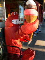 Serving up lobster ice cream (No kidding!) |
Back to our motel to read, relax and getting ready for tomorrow’s biking day.

Studying the guide books |
9/14 - Friday - Glorious Biking (Acadia National Park)
We had breakfast at “2 Cats” and meet the town goof ball while we were waiting in line. His girlfriend just broke with him after 7 years and he was heartbroken. He was a sweet guy and told us where we could park all day for free.
After breakfast we rented bikes at Acadia Kayak and Bike Rental. We biked to Acadia Duck Pond and spent the rest of the day on beautiful carriage roads that Rockefeller built. No cars or motor vehicles allowed on the 57 miles of glorious scenery – trees, ponds, hills and even a deer to greet us. We crossed several wonderful old stone bridges.
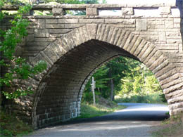
A stone bridge on the carriage roads |
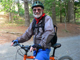
Bill on his bike |
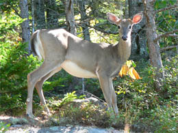
Deer to greet us |
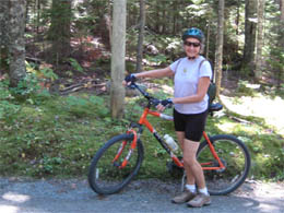
Nancy on her bike |
We biked to the Jordan Pond House, got a coke and had bagels and cream cheese (that we ordered from “2 Cats”).
Jordan Pond |
Lunch at Jordan Pond |
We meet a couple, Karen and Robb, from Redding, California. They love to bike and have similar interests. (Just like us, they used their expiring frequent flyer miles to get them across the country.)
Later in the afternoon, the clouds moved in, the wind picked up -- felt like a storm was brewing. We had biked for about 6 hours, but really weren’t ready to leave the quiet peaceful carriage roads. However, we didn’t want to be caught in a storm, so about 4 o’clock we called it a day and headed back to Bar Harbor to return our bikes.
Clouds gathering |
Storm moving in |
Next, we went to the library to check our e-mails. Just as we were leaving the library, we saw Karen and Robb biking across the street. We flagged them down to chat some more.
Then we trudged off to the Laundromat with a bag full of dirty clothes. During the dry cycle we walked to Rosalie’s Pizza for a beer and who did we find but Karen and Robb again having a pizza. (Bumping into the same people over and over happens all the time while we’re traveling. We really weren’t stalking each other!) We enjoyed more conversation along with some Moosehead beer.
After we folded our clean clothes, we went to the Lobster Claw (54 West Street, Bar Harbor) for dinner. We met Barry, the hassled, over-worked owner of this walk-up and order place with a few tables scattered about. Most of his customers were locals just stopping in take-out. You could tell everyone liked Barry – although he was a little grumpy and very tired. We liked his food and the funky environment.
We finished in time to go next door to the Whale Museum to hear the author, Scott Kraus, lecture on his book, “The Urban Whale.” The book is about right whales, named by the early whalers because they were just the right whales to slaughter. Same old sad story of destruction – These whales were once plentiful along the east coast, but now their total population is only about 300. Scott Kraus has been studying the “right” guys for about 30 years. He is very passionate about his work -- I thought of him as the advocate for the whales.
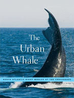
The book by Scott Kraus |
He told us alarming stories about ships slicing up whales in their propeller and the Navy bombing them for ten or twenty years after WW II.
One story was about Delilah who was migrating with her baby in 1992 when she was struck by a ship’s propeller in the Bay of Fundy and was killed. Her baby, named Calvin (after the cartoon), swam off. No one expected Calvin, the baby calf, to survive without his mom. Delilah’s remains were taken to a warehouse on the Bay of Fundy so scientists could study the body. Delilah’s skeleton and baleen are now on display at the New Brunswick Museum in Saint John. (We visited her there a few days later.) The story has a nice ending. In August of 2005, 13-year-old Calvin (who turned out to be a girl) survived and was in the Bay of Fundy with her own calf. This event thrilled scientists and the locales who welcomed Calvin as a symbol of hope for the vanishing species.
How did they know it was Calvin? Well, Scott Kraus has documented the family trees of almost all the right whales. He finds a lot of the genetic information from their scat. They take dogs trained to sniff out whale poop on boats. The dogs guide them to the poop and the dogs get rewarded with a ball.
As one might expect, Kraus has harsh words for the way the Bush administration is “protecting the environment.” We’re in a dire situation now. Lots of local lobstermen were at the lecture because some of the regulations being suggested to protect the right whales will affect the lobster industry (regulations on types of ropes, types of traps, types of buoys, etc.). During the Question and Answer period, a lobsterman expressed his frustrations with Kraus and his efforts to protect the right whale. What was interesting to me was the respect both men showed toward each other. The lobsterman said to Kraus, “You see the big picture. I’m here to continue what my family has done for years -- fishing.” In this divisive world, I had forgotten that civilized people could still debate issues. Fascinating discussion – We got back to our motel about 10 to pack for our next adventure. |