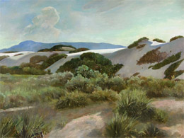
| Sunday, 5/17/09 – San Diego to Fredonia, Arizona
We leave the house at 7:00 a.m. to embark on our long journey. We listen to a book on Andrew Jackson to help pass the time.
We reach Las Vegas about lunchtime, right on schedule. Bill knows the way to a Vegas “super-duper special buffet.” However, the exit on I-15 (and several adjacent exits) are closed for road work, so our best-laid plans are foiled. Because of the traffic and closed exits, we miss our killer buffet and head down the road in search of good, cheap eats. Finally, at 2:00 p.m., brain dead from no food, we find a little Mexican place in Mesquite, Nevada, just west of the Arizona border. I order my usual burger and fries because I always do that on my first road trip day -- a thing left over from childhood. Bill eats a massive burrito. After lunch, we waddle to the car in the afternoon heat, stuffed to the gill, with arteries snapping shut.
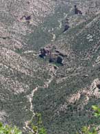
We listen to more Andrew Jackson. We finally leave I-15, turning east on Hwy 9 toward Hurricane, Utah. We dip south on 389 toward Fredonia and are back in Arizona again. It is our first time in this part of the country – and what beautiful country it is.
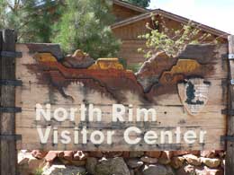
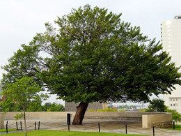
Pipe Spring National Monument
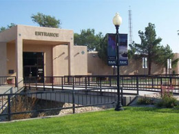
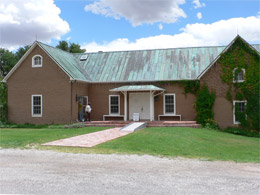
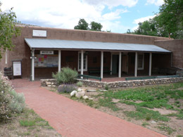
About 3:00 in the afternoon, we stop at Pipe Spring National Monument just outside Fredonia, Arizona. We need to stretch our legs and Pipe Spring Monument is the perfect spot plus we have our National Park Golden Age Passes for free admission.
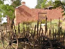
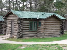
Pipe Spring National Monument |
Pipe Spring National Monument |
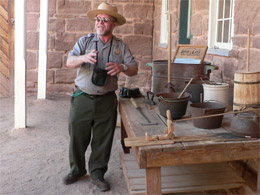
A real Indian (oops – I mean Native American) greets us at the front desk in the Visitor’s Center. Next, a darling little, elf-like Ranger with rosy cheeks takes us on a tour. He is thrilled to share the history of this place, which he obviously loves.
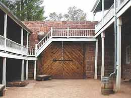
Pipe Spring Courtyard |
Elf-Ranger in the Courtyard |
A Brief History - Pipe Spring National Monument
Pipe Spring was once a grassy site in the desert watered by three springs and used by humans for thousands of years. Flowing water made it possible for plants, animals, and people to live in this dry, desert region. Ancestral Puebloans and Kaibab Paiute Indians gathered grass seeds, hunted animals, and raised crops near the springs for at least 1,000 years.
Then one day, in 1863, a couple of Mormon guys (Dr. James Whitmore, a pharmacist and his brother-in-law Robert McIntire) purchased the land. By 1865, the hardworking pair had cattle and sheep at the springs. They ran longhorns up from Texas to graze on the land. They also planted grapevines and fruit trees. Then, just three years later, a party of Navajo raiders ambushed and killed the doctor and his brother-in-law.
In 1869–70, the Mormon pioneers (under the edict from Brigham Young to expand into new territories), established Pipe Spring as a church tithing cattle ranch. Mormons came out here “on assignment” from all around to work the place. They paid their tithes with livestock, crops or labor, not cash. Twice a month, 10 to 30 steers were driven from the ranch to the tithing office in St. George, Utah. The covered wagons that went along carried a load of butter and cheese. Hundreds of men in St. George who worked on pubic roads and the St. George Temple and Tabernacle received their pay in shares of beef, butter and cheese.
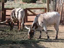
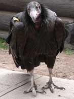
Descendents of the Early Longhorn |
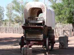
Covered Wagon Transportation System |
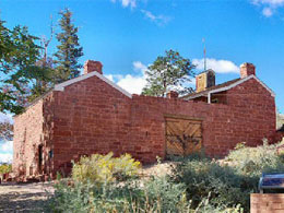
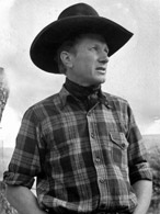
By 1872, the Mormons constructed a fortress over the main spring and built up a large cattle ranching operation. The place was named Winsor Castle after Anson P. Winsor, the first superintendent of the ranch. He and his wife Emmeline ran the operations for the first six years.
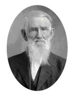
Anson P. Winsor, CEO |
Pipe Spring Fortress |
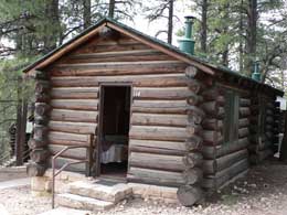
This isolated outpost was also a way station (AKA “B&B”) for people traveling across the Arizona Strip in that part of Arizona separated from the rest of the state by the Grand Canyon. |
Our cute little Ranger takes us around the frontier refuge and tells us stories of the folks who worked here and the early tourists who passed through. The travelers passing through raved about the homemade pies – a very special treat. Rain barrels, in the courtyard, collected rainwater for the ladies to wash their hair. Rainwater was so much softer to use than pipe spring water. What a great place to stop after a long, dusty day on the trail.
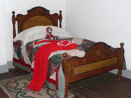
The "Bed" in B&B |
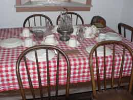
The "Breakfast" in B&B |
Even before Winsor Castle was completed, Brigham Young (in 1866) established The Dessert Telegraph system. The Mormon community insisted on connecting the families in this remote location to other Mormon settlements and Salt Lake City, Utah, especially during the Black Hawk and Navajo conflicts. By 1871, Pipe Spring became a telegraph relay station. The gals who ran the telegraph system were not allowed to divulge any of the messages or family secrets to others.
This outpost served not only as a protection from the Native Americans, but also as a refuge for polygamist wives (running from federal marshals) during the 1880s and 1890s. The local Native Americans (Kaibab) didn’t give the Mormons any trouble, but the surrounding tribes were a pain.
The bunkhouse out back was for the ranch hands who managed the cattle. Some worked year-round while others were hired from time to time for roundups and branding. Some cowboys worked to pay their annual tithe to Mormon church. This is cowboy country. They were an important part of Pipe Spring and Arizona Strip life through early 20th century.
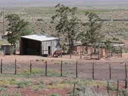
Part of the Ranch |
Bill Checks out the Back Yard |
We leave Pipe Spring with a greater understanding and respect for what the pioneers (and Native Americans) must have endured. We drive down the road to Fredonia to find a cheap motel for the night. (We could only book 2 nights at the North Rim of the Grand Canyon – so we need to spend one night outside the park.)
Bill, armed with his research on motels in Fredonia, learns that his chosen spot is closed, along with the restaurant next door. (Foiled again!) We are tired and only want a place to lay our weary heads. Where is the Travel Goddess when we need her?
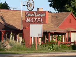
Bill calls to check on a motel in the next town (Jacob’s Lake), the last stop before the Grand Canyon. The receptionist puts us on hold for what seems like forever. We debate whether to hang up. Finally, she picks up the phone and we are promptly disconnected. We decide not to head on down the road without a booking at a motel, so we find a real dump in Fredonia – The Grand Canyon Motel – a place left over from the 50’s. We check the room -- sheets are clean, bathroom towels are thick, and the price is right - $38 / night. I notice a dozen or so of cats running between the scattered cabins and worry about Bill’s allergy to the little beasts. The owners reassure us the cats are never in the cabins, but only stay outside to keep the rat population down – now that’s a relief.
The Grand Canyon Motel in Fredonia |
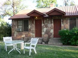
Our Cozy Little Cabin - No Cats Allowed |
We take a very short drive through the greater metropolitan area of Fredonia – What a sad sack place. We find a convenience / gas station that sells guns, ammunition, ice cream, cold drinks and various other supplies. We buy a small carton of milk for breakfast at the ammo counter – Totally weird place.
We go back to our motel, unpack and down a beer. Bill and I are grumpy with each other. Except for Pipe Spring, our day had not gone well.
I desperately swim through channels not believing what’s on the public airwaves these days. My morbid curiosity stops me at a program called “456 Ways to Die” with video documenting a variety of strange deaths. When I can’t take the program (or the room) anymore, I grab my camera and head out the door to explore the crumbling neighborhood. Just an hour with my camera in the late afternoon changes everything. The twilight hour cools everything down and the long shadows accent the most ordinary of objects. No matter where I am, it is nice to study things on foot (and not from behind a bug splattered windshield while grinding out the endless freeway miles).
Oh the Sites You See on Foot |
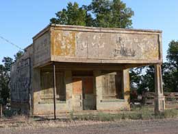
Long Shadow Hugs the Old Gas Station |
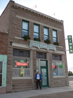
I go back to the motel and find a more mellow Bill. (He needs to be free of me as well.) We go down the road in search of dinner. The CR Diner, a combination good old home cooking and a disco joint is the only place in town that’s open. (It’s Sunday night and Fredonia is going through so tough times.)
We are the only customers so we certainly have our doubts. To our great surprise, our dining experience turns out to be truly wonderful. The thin, aging owner (and his cheery little wife), although beaten up by life, still represent the good old American, “can do” spirit.
We eagerly listen to his sincere tales. He spent the best part of his life working the Uranium mines around the Grand Canyon. His timing was never quite right. He lived in Moab, but wanted to move to Fredonia a couple of years ago to start his own restaurant and to be close to the family. The housing market went south and he couldn’t sell their home in Moab. He moved anyway, and the renter turned out to be problematic. Unfortunately, after he and his wife poured money and labor into the diner, their dream restaurant, the travel industry went south as well. Now, with $30,000 in debt, they wonder if they can hang on.
The owner is very proud of his business and we are charmed by the funky place he and his wife have created -- the huge crystal ball twirling in the disco room, the black and white booths lining the dining section (found by their son at a garage sale) and the huge fish tank at the entrance. We learn the names and antics of each fish – Lazarus has only one eye -- He flipped out of the tank one day during cleaning. Red, the peace maker fish, keeps a couple of the fish from head-to-head combat. The silly little catfish (who's name escapes me) likes to swim upside down and scratch his tummy on the underwater castle.
After getting to know the fish, the owner describes to us, in the most gourmet of terms, how his wife cooks the hamburgers just right (to retain the juice) and how they only use real potatoes for the French fries.
Today was not our best travel day -- things just didn’t seem to come together, but the evening at The CR Diner made it all worth it. We drove back to our motel, happy with our evening of good food and entertainment.
We were also feeling good that we put over 400 miles behind us and now feel like we are officially on vacation and ready to do the North Rim of the Grand Canyon.
Monday, May 18 – Fredonia to Grand Canyon – North Rim
We woof down some cereal in our $38 motel room (which isn’t so bad after all) and are on the road in no time.
We drive through Jacob Lake and then the Kaibab National Forest with rolling hills sprinkled with Ponderosa Pine, Aspen, fir and spruce. However, some of the trees aren’t doing so well. We don't know what kind of varmint is invading them. We notice a few patches of snow on the ground, We feel lucky to have the warm sun overhead. (It can be very cold in May on the North Rim.) From the road, we don’t get much of a peek of the actual Grand Canyon – that surprise will come later.
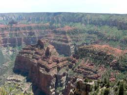
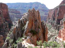
Grand Canyon - North Rim
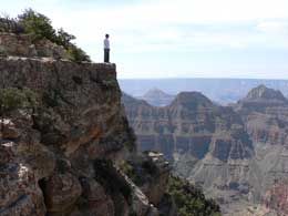
We arrive at the North Rim (Grand Canyon - altitude 8,800 feet) shortly after 8:00 a.m. We stop in at the Visitor’s Center to get our bearings and figure out what to do in the park. An enthusiastic, seasoned Ranger gives us a map and marks it with her favorite hikes. We are now ready “to do” the park.
The Grand Canyon |
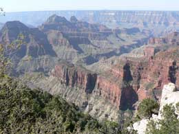
My-oh-My |
We first explore the village area. We love the old lodge. It was built in 1928, destroyed by fire and rebuilt in 1932. Fabulous place – limestone walls and open beamed rafters probably made of the lodge pole pines. From the lobby at the back of the old lodge, we get our first real look at the Grand Canyon's North Rim – Magnificent, My-oh-my!
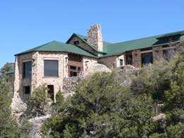
Back of the Old Lodge |
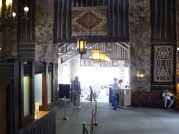
Grand Entrance |
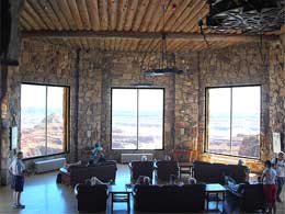
Lobby |
Bright Angel Point Overlook Trail |
We stop at the saloon. Bill gets tea (coffee for me). Bill gets a muffin (bagel for me). The bartender is a happy guy. The place just opened for the season 3 or 4 days ago. We see nothing but friendly staff, excited to be back at work.
We eat our mini-breakfast in the warm morning sunlight sitting on the veranda outside the old lodge, soaking up the views. We take a short overlook hike to Bright Angel Point. I snap photos like crazy – Thank heavens for digital.
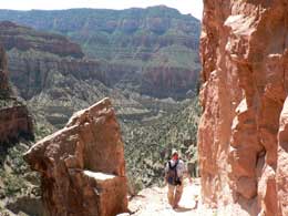
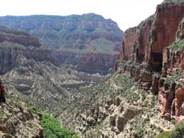
We walk to the car and add ice to our ice chest to make sure we’ll have a cold brew after our day of adventure. We take the 23-mile scenic drive stopping along the way to do some hikes. We get glimpses of the spectacular Grand Canyon through gaps in the forested areas. The Native Americans must have loved it here.
Our first hike, Cape Royal, is an easy half-mile trail with views of the Colorado River and Angel Window. We hike over the Angel Window arch and feel suspended in air over the canyon.
After the hike, we find a picnic area to share a peanut butter sandwich and a Dr. Pepper. We are both feeling tired. The altitude is getting to us – 8,800 feet is an adjustment for us flat-landers. In addition, it is an unusually hot day for this time of year – 85ish (with a high of 103 in Phantom Ranch). The heat and altitude are taking a toll on us.
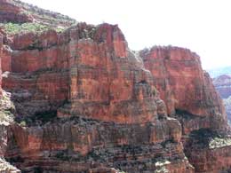
After lunch, we find the trailhead to Cliff Springs, a quiet, peaceful trail highly recommended by the Park Ranger. It is everything she promised. We meander down the mile long trail through a forested ravine. Then the trail shoots up and before we know it, we are walking up along the side of a cliff with amazing red stone overhangs. The red sandstone trail is etched into the cliff. At times, we duck under the overhanging boulders. The official trail ends at the springs tucked behind a boulder lodged on a cliff. We hike a little beyond the boulder where Indians once traveled, enjoying grand views of the canyon.
On the way back, we check out an ancient granary. For a thousand years or so, the Pueblo Indians used it to stash their crops for winter. (The white man easily wiped out Native Americans by setting fire or destroying these granaries – a little fact I learned in Yosemite).
Next, we tour the Walhalla Glades to see a Puebloan summer home. (They retreat down into the Grand Canyon during the winter months.) The not-so-big or impressive stonewall ruins date from between 1050 A.D. to 1150 A.D. Only about 20 people lived in this particular spot. However, across the Walhalla Plateau, over 100 farm sites have been found. I piece these facts together with the aid of a trail brochure. However, we leave with a “What’s the big deal?” attitude. We need a trained professional (i.e. an archeologist) to show us around.
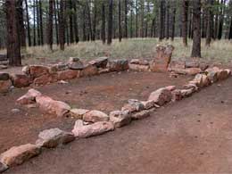
Walhalla Glades - Puebloan Ruins |
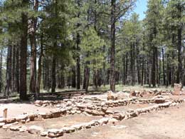
Where the Puebloans Once Summered |
We continue on the scenic drive, stopping at a few overlooks. One overlook is named for Teddy Roosevelt to honor of his efforts towards the preservation of the Grand Canyon.
NOTE:
Later on our trip, we listen to the book, "Theodore Rex," and learned about Teddy Roosevelt's western travels, where he spoke of the Grand Canyon 1902:
“Leave it as it is. You cannot improve on it. The ages have been at work on it, and man can only mar it. What you can do is to keep it for your children, your children’s children and for all who come after you, as the one great sight which every American should see.”
Colorado River |
View from Teddy Roosevelt's Overlook |
Inspired by Teddy, we decide we have one more hike in us. The guidebook promises a 4-mile hike to Point Imperial on a trail hugging the Grand Canyon. After trudging through 2 miles of badly burnt forest from a fire in 2000 with no views of the canyon, we turn back, tired and bored and thinking the great views were probably just around the corner.
We drive slowly back to the lodge, not out of choice. We are stuck behind an old lady driver. The road is winding with hairpin curves where passing is not an option. We listen to more of our Andrew Jackson book to get our minds off our entrapment.
We arrive back at the lodge about 2:30, hoping our cabin is ready. It’s not – but the friendliest people at check-in greet us with: “Sorry, come back later.” They do it in the nicest way. We drink a cold beer and go back for another friendly “NO.” (We get to know the staff pretty well. Ginny once taught school in Tulsa.)
We kill more time by hiking part of the Transept Trail, which follows the canyon rim from just behind the lodge to the campground. What struck me about that hike is the variety of bird sounds I heard filtering down from the trees overhead. (Were they really birds. . . or Native Americans signaling to each other? I watched too many westerns as a kid.)
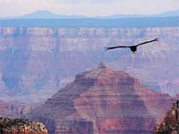
We return to the lodge to wait in another long line at check-in. Bill and I take turns waiting in line while the other dashes outside to catch bits and pieces of a Ranger talk on condors. Right on cue, a condor makes his entrance overhead to stop the show. What a site!
Condor Making It's Grand Entrance |
Showing Off for the Crowds |
Finally, we get the word from the friendly receptionist that Cabin 114 is finally ready for our occupancy. We roll our luggage through wooded area only to discover that 114 is still not made up. We sit outside drinking wine while we wait for more friendly staff to change the linens.
Cabin 114 |
Home, Sweet Home |
We like our new home. We shower, relax and then walk back to the lodge for dinner at 6:30. (Bill made reservations for dinner from San Diego – and it’s a good thing because the place is booked for the 2 nights we’re here.)
Margaret, a happy, together-like gal, is our waitress. She said she worked for CBS for 15 years, but didn’t get her contract renewed so she headed to Grand Canyon to fulfill her lifelong dream as a waitress. It didn’t compute, but then again, nothing in our economy computes. Bill orders the meatloaf and I, the trout. Mine is the better choice. We love the evening and the old dining room. What a great place.
We go to the 8:30 Ranger talk about geology in the canyon. Ranger Bill Steale takes us on a virtual tour in the Coconino Plateau with photos from a back packing trip he did with his buddies. He is interesting, but packs so much into the talk, I can't possibly comprehend all the facts. He took us back 100 million years ago when the area was inhabited by strange critters living in the sea – and there’s plenty of fossils to prove it. I guess the big picture is the Grand Canyon is caving in and changing – no surprise there.
At 9:30 pm, we smuggle up in our cozy little cabin. Life is good!
Tuesday, May 19 – Hike into the Grand Canyon – North Kaibab Trail
We get up early for our big hike into the Grand Canyon. At 6:30, we eat breakfast at the lodge, then pick up our box lunch (turkey sandwich) and drive a few miles down to the Kaibab trailhead. It is a beautiful day – temperature in the 70’s and we have acclimated to the altitude and are full of energy.
At 8:30 a.m., we are heading down the North Kaibab Trail, the only maintained trail into the canyon from the North Rim. The first 2.5 hours are downhill on a trail that draws us deeper and deeper into the canyon – the most dramatic hike I’ve ever seen. We are giddy from such beauty, oooing and ahhing with the other downward bound hikers. We stop at every corner to snap a photo to document the amazing scenery.
The Coconino Overlook (at .7 miles down) is incredible. Wish I could remember some of the facts from the Ranger’s talk the night before. We snap some photos of another couple and then pose for our own photo with the Coconino in the background.
Right before the Supai Tunnel (2 miles down) a crew of kids with “attitudes” are working on the trail. We take a break to have a snack and watch the mules resting. This is the end of the trail for the mule train. It costs $75 for two hours. To protect the poor mules, anyone weighing over 200 pounds is not accepted.
Supai Tunnel |
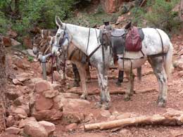
Mules Resting for Their 2 Mile Trek Out |
Right after the Supai Tunnel, the trail gets very interesting. I am paying more attention to the magnificent geological formations than the trail and with one little missed step down I go, slightly twisting my ankle. Luckily, no real injuries – nothing that an Advil can’t fix. However, the incident causes me some concern about crawling out of this steep canyon.
We cross the Redwall Bridge (2.6 miles down) and are drawn deeper and deeper into the canyon.
The trail lures us to the Eye of the Needle (3.5 miles down). We want to dash ahead to see what is beyond each turn. We stop at the Eye of the Needle to eat half of our lunch and then continue on. (I claim lack of food weakens my ankles.)
Eye of the Needle |
What's Around the Next Corner? |
It’s 11 a.m. We assess the situation. We have been hiking over 3.5 miles (2.5 hours) down into the canyon. We want to make it to Roaring Springs (4.7 miles), but the warnings posted everywhere clearly state that it takes twice as long to climb out of the canyon as it does to go down. Therefore, we figure we are facing a 5 hour climb out of the canyon. WRONG – it only took 3 hours to get to the rim – but we didn’t know that at the time. We turn back. We are back on the rim at 1:30, wishing we had gone on to Roaring Springs. We could have made our 4.5 hour / 7 mile roundtrip much longer.
A Few Shots Before We Turn Back |
North Kaibab Trail |
However, it is still a 3-mile relentless climb out of the canyon. At times I wonder if I can make it. We watch the clouds building over the canyon all day. A little rain finally comes our way. First there are just a few sprinkles followed by a light, refreshing soaking. It cools things off and helps me escalate my pace. (I always run to get out of the rain.) The rain wets down the dusty trails and makes everything smell so lovely. Exactly what we need -- Thank ya Lord.
We are back to our cabin with a cold brew by 2:30. We relax and shower and go to the 4:00 Ranger Talk on Condors – with another dramatic overhead flight by our Condor friend. California Condors fascinate us – This is what we learned:
A little background
- California Condors almost did not survive man. They were killed for many reasons: Californian gold rushers used the hollow of their feathers to hide gold powder; ranchers and farmers viewed them as pests (along with foxes, coyotes, etc.) and killed many of them; condors got lead poisoning when they ate the carcasses of animals killed by bullets.
- There were only 22 Condors left in the wild in 1982 when man intervened to try and save them. The last one was captured from the wild in the late 80’s for a breeding program that seems to have worked.
- Condors only lay one egg at a time, but if somebody takes that egg from the nest, the mother would lay another one. The pilfered eggs were taken and hatched in captivity at the San Diego Zoo and the chicks were raised and hand feed by Condor puppets.
- In the 90’s, the Condors were re-introduced to the wild near L. A., and in the Grand Canyon. Now Condors have very few predators – and also have very little fear.
- 70 or so condors now live in the Grand Canyon. They are tagged with identity flags and GPS tracking systems. (The birds must be caught every couple of years to change the batteries.) The Rangers all love these Condors – and what a grand site to see them soaring in skies over the Grand Canyon.
Some More Facts about California Condors
-
Condors are 3.5 to 4.6 feet long, weighing around 30 pounds.
- They have a 9 ft. wingspan – They soar; never really flap.
- They live up to 60 years and reach maturity at 5 or 6.
- They lay 1 egg at a time (which made the captive breading program successful).
- It takes about 2 months for condors to hatch from the egg.
- They spend one year raising the baby Condor.
- They like to live in high caves. (The Grand Canyon is a great place for them – with the updraft for soaring and all the high caves. In fact, bones of ancient condors were found in these very caves.)
- Condors do not have vocal cords so they force air through their body to make hissing and grunting noises.
- Condors defecate on their legs to reduce their core body temperature.
- Condors are genetically related to storks.
- Adult condors show their emotion through skin color changes. (Their baldheads turn reddish pink heads during courtship or when the birds are excited or alarmed.)
- Condors eat an average of 2-3 lbs at a feeding.
- When scared, condors regurgitate or throw up.
- Condors do not have talons, or claws, like eagles, hawks falcon, owls; Condors nails are more like toenails.
- Condors are vultures or scavengers who feed on decaying animals.
- Condors are clean. They bathe frequently and spend hours smoothing and drying their feathers. After eating, they clean their heads and necks by rubbing them on grass, rocks, or branches.
- They have a hardy and effective immune system, so they don’t get sick from any of the bacteria from decaying animals.
- Condors are prehistoric birds and survived the ice age after no big animals were left to feed on.
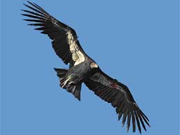
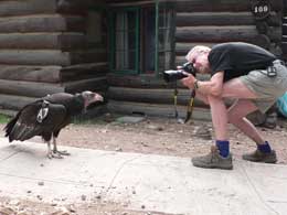
After the talk, I stop in at the Gift Shop to buy Zi a little coyote stuffed animal. When I return to our cabin, a crowd of about 20, is gathered. I notice Bill taking photos of a very friendly Condor (aka A-7). The bird is about 2 feet away from him and is trying to befriend Bill.
I learn that the condor actually tried to go into our cabin – but somebody shut the door, just in time. The Ranger is summoned and comes running. He tries to shoe the big bird away, but A-7 has a mind of her own. Apparently A-7 loves people and just wants to hang out by the cabins. She’ll be going back to condor re-training school. She’s 5 and didn’t learn how to be a condor the first time. She provides us with plenty of good excitement. She looks far more beautiful soaring in the air than walking on the ground. For the night, she settles high in a pine tree towering over the cabins. She slept there. How do I know? I checked on her 3 times.
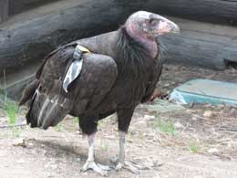
Our Friendly Condor, A-7 |
Smile for the Camera |
Go Away |
You're a Condor |
Bad Girl |
We eat dinner in the wonderful old lodge at 6:30. Friendly, apple muffin Audrey from Iowa, is our server. The veggie pasta is greasy, but the hot bread is good and the sunset, magnificent.
We walk back to our cabin in the darkness and call it a day – and a mighty fine day at that. We face a long drive tomorrow.
Wednesday, May 20 – Grand Canyon to Santa Rosa
I wake up with a sore ankle. It’s a good thing I didn’t realize that I really injured myself yesterday on the trail in the Grand Canyon, or I may never have made it back up to the North Rim.
We eat a bowl of cereal in our cabin early so we are on the road by 6 -- Lots of driving today – about 626 miles to be precise. We retrace our steps, following 67 North to Jacob Lake where we pick up 89 East.
I see some eye popping red sandstone formations just outside the little town of Marble Canyon, so we stop to explore. I snap a few photos and want to follow a trail (that involves a wee bit of trespassing). Bill is not interested so we get back in the car and continue on our journey.
It was only a few miles when we come upon another amazing structure – this one man made. The Navajo Bridge, first built in 1928 (834 feet with a height of 467 feet), sits over the Colorado River. We park the car at the Visitor’s Center and dash across the bridge on foot, gasping at the views of the Colorado River down below.
Our next stop is the Sunset Crater Volcano National Monument, about 14 miles northeast of Flagstaff, just off US 89. We just happen to miss the best part of the area – The Wupatki National Monument. Photos of the ancient dwellings of Puebloan people on the brochure look really cool. Oh well, no time to re-trace our steps so we make the best of the Sunset Crater.
At the Sunset Crater Visitor’s Center, we only have a few minutes to absorb all the facts. The 1,000 feet high cinder cone was an active volcano 900 years ago. It’s final eruption spit up iron and sulfur giving the rim that “sunset crater” glow. The display information washes over me. What I do remember is jumping on the seismic scales anchored to the floor that measures the mini-quakes one makes. Bill’s jumps are much more powerful then mine.
Outside, gray clouds gather. We know we have very little time for a hike on the Lava Flow Trail where we get a peek at the 1,000-foot volcanic cone. The lava trail and the park are the cleanest; most well scrubbed national park I’ve ever seen. Reminds me of Jurassic Park without the dinosaurs. We whiz by some other old gray haired visitor like ourselves -- only they are strolling on the well paved paths. We are type A’s on a mission to see it all before the storm hits. It seems as if the only people traveling these days are Europeans or us aging baby boomers who now enjoy the time of our life.
We gobble down our peanut butter sandwich on the perfect picnic table as we watch the storm-brewing overhead. When the first drops fall, we quickly finish up, load the car and are on the road again.
We head east on I-40 East, with 433 miles to Santa Rosa, NM, our destination for the day. We are in for a lot of “white knuckle driving” with some mighty scary thunderstorms pounding on us. The situation is exacerbated by a steady stream of big rigs interspersed with RV’s. There are times when we can’t even see the traffic, just the rain pouring down our windshield. It’s impossible for the wipers to keep up with the deluge.
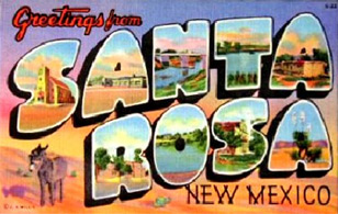
As we enter New Mexico, there is a break in the storm. We stop at the state Visitor’s Center for a coupon book and a pee. I gather travel guides from the racks of brochure.
Back on the road to Albuquerque, we analyze coupon options for motels and watering holes in Santa Rosa. The sun is going down just as we pull into the Best Western (on Rt. 66). The coupon saves us 6 bucks. The room is quiet and clean and a great respite from our long, hard, stressful day of driving. (Thank goodness we are planners and have cold beer in the ice chest.)
Bill studies the travel guides and finds a great little café in town called “The Lake City Diner,” right across from the old courthouse. Bill orders enchiladas and I, the chicken fajitas – very tasty. The diner was once an old bank with the heavy old vault doors still in place. Again, I notice the restaurant clients all look like us – gray haired couples on an adventure. After all, Route 66 is right outside the door. (The only difference I pick up is that the other couples are having wine with dinner at about 7 or 8 bucks a pop. The cold beer in the ice chest is just fine for us!)
The Lake City Diner - Bill at the Door |
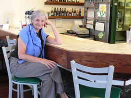
Nancy at the Lake City Diner Bar |
The old town center of Santa Rosa is very charming place. After dinner, we stop at a local grocery store to replenish our supplies of beer and almonds. (I am struck by the large plastic Mother Mary over the cash register.)
Right on Route 66 |
Thursday, May 21 – Santa Rosa to Tulsa
We enjoy an “extended continental breakfast” in the motel. The waffles are a hit. We chat with some fellow retired aging boomers. I remind myself that we are the luckiest generation to have ever lived – with freedom to travel and see so many interesting places on the road.
We face another long drive today -- 533 miles, passing through the Texas panhandle (Amarillo) and then on to Oklahoma. Texas offers very little for my soul with it’s flat, dry, unending country. Only humongous billboards break up the landscape, promoting such disgusting things as 72 oz. steaks (You Eat it all and it’s free.) The scenery changes almost immediately when we cross into Oklahoma. I see rolling hills, farmhouses and carpets of wildflowers. I can breathe again.
Oklahoma City Memorial Museum
We arrive in Oklahoma City about 3:30 and head straight to the Oklahoma City Memorial Museum. Last time we were in Oklahoma City (I believe it was in 2000), we didn’t have time to wait for the museum to open. I vowed that if we were ever back in Oklahoma City, we’d stop – so here we are.) It is a glorious spring day – flowers in bloom, green green grass, blue blue sky and a strange, quiet calmness.
The Oklahoma City Memorial Museum honors 168 men, woman and children who died on April 19, 1995 from the bomb Timothy McVeigh left outside the Alfred P. Murrah Federal Building. It also honors all the survivors and the rescuers. Every section of the memorial is done with feeling and sensitivity.
The Gates of Time are huge, twin entry gates on the grounds that frame the moment of destruction – 9:02 a.m. “9:01” is etched in The East Gate, representing 9:01 a.m., one minute before the blast. The West Gate displays “9:03,” the moment after the bombing madness was over and life changed forever.
Between the gates is the reflecting pool, which is soothing and calming. On one side of the reflecting pool is the Field of Empty Chairs. The field is very powerful with its 168 empty bronze chairs, lined up in rows, represent each person who was killed. Of the 168 chairs, 19 are smaller chairs for the children who died. Arranged in nine rows, one for each of the nine floors of the building, they are placed according to the floor on which each person was killed. Victims’ names are etched on each chair. At night, the base of the chairs light up.
The “Survivor Tree” is a 90 plus year old American Elm that stood on the grounds during the violence and somehow, managed to survive and become a symbol of resilience and hope.
“Survivor Tree” Survived the Oklahoma Bombing |
The most personal memorial on the grounds is part of the fence left over from the makeshift memorial that stood here for five years (before the museum was constructed). It’s a place where the living leave tokens of love to the victims. Letters, photos and stuffed animals that cling to the fence broke my heart. This is where we first see the victims as real people, not as numbers or statistics.
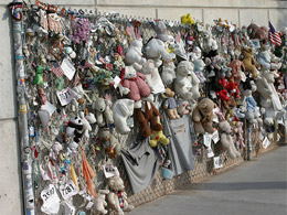
Memorial Fence |
Someone's daughter, sister, sweetheart |
Inside the Museum (no photos allowed):
After exploring the grounds, we pay our fee and enter the museum. The museum begins on the third floor so we take an elevator up and then walk down through the displays.
A tour guide reviews events from that terrible spring day in 1995. Using a model of downtown Oklahoma City, she points out the movements of Timothy McVeigh and the rented Ryder truck. Then we watch actual footage taken by a security camera that captured the scenes of the truck arriving.
The guide then takes us to a plain, government meeting room that is set up to look like the hearing room for the Oklahoma Water Resources Board back in 1995. On the day of the bombing, across the street from the museum, the Water Resources Board was conducting a hearing (being taped), which started at 9 a.m. We listen to the actual audiotape from the hearing. Two minutes into the tape recording (9:02 a.m.), we hear the explosion and then the chaos. This is the only recorded sound of the bomb blast. We sit silent with the other visitors while all 168 faces flash up on the wall, looking down at us.
We walk from the hearing room through double doors and into a large room filled with displays of chaos and confusion that took place in the city. We watch the first helicopter news footage of the bombed out building taken at 9:13, 11 minutes after the blast. We see the remains of mangled artifacts – twisted file cabinets, singed rolodexes, ripped open brief cases, melted coffee cups, crumpled employee badges, and other everyday items that have become tokens of horror.
We listen to the recorded pleas from victims buried in the rumble. (One doctor on the rescue mission had to amputate a young woman's leg in order to remove her from the steel beams that trapped her.) We watch eyewitness accounts, actual news footage, rescue missions, and how the surviving loved ones waited. We hear parents desperately trying to locate their toddlers who they left in the building’s nursery school that morning. The class photo of those innocent faces in nursery school taken 5 days before the explosion is forever imbedded in my brain. We view a videotape of a young man looking for his new bride. We are mesmerized by the stories of the survivors as they tell their own stories. It was gut wrenching.
Another large room documents what it was like to have the world media flock to Oklahoma City to cover the news of the bomb and send out special bulletins. The old familiar newscasters, like Tom Brockaw and Peter Jennings, have aged some after 14 years. (Bill Clinton has really aged!) There were also all sorts of celebrities and politicians who poured into Oklahoma City. After a huge memorial services, the governor’s wife handed out teddy bears for comfort. Bill and Hillary Clinton were at the service.
There are so many stories of family, support teams that descended on the area. The photo of a fireman holding a limp baby (Baylee Almon) won a Pulitzer Prize and touched our hearts. (Baylee didn’t make it.)
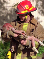
Fireman Holds Baylee
Pulitzer Prize Photo |
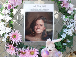
The Gallery of Honor is a small room filled with photographs (and personal artifacts) of each of the 168 victims and the one that really gets to you. Kleenex boxes lined the benches. I wonder how many tissues they go through a day – you couldn’t leave without shedding a few tears.
We are pretty wiped out by the time we get to “funerals and mourning” section. Tears flowed freely, but we carried on.
Our museum-objective mode returned when we enter the section on the bomb investigation. It was good to lay the emotion aside and study the evidence used to piece together the case against McVeigh and Nichols. We saw crime scene photos, parts of the rental truck and FBI evidence boards used in the trails. In a small display case we see the actual key McVeigh tossed in the grass on his way to his get away car – a miraculous find and a key piece of evidence.
Nichols is serving life in prison. McVeigh was hanged, after his favorite meal, which included mint chocolate chip ice cream – I hate mint chocolate chip.
This is a tough museum to get through. All that was left was signing the registry and checking out the Gift Shop. What on earth could they sell? T-shirts of every kind and stuffed rescue dogs for the kids for only $12.95. I could not bring myself to buy one for Zi.
 Souvenirs Anyone? |
The stuffed animals in the Gift Shop did not erase my powerful emotions. This place will certainly stir your heart.
 Good-bye Statute |
We leave Oklahoma City in an emotional whirlpool. We still have a couple of hours of driving to get to Tulsa. We drive in silence until we arrive in the outskirts of Tulsa and then scramble around checking various maps to find our exit to the Doubletree.
Jon, the big friendly Italian door-person, helps us get settled into our room. We have a beer and then call Brother Tom. He recommends a pizza stop (Hideaway) on our way to Dad’s new home in the Sand Plum Nursing Home. We have trouble finding the restaurant, the pizza takes longer than we expected (but well worth it) and we don’t get to Dad’s until 9:30 p.m.
Dad is still up. He left the porch light on. We gab until 11:30. He offers me everything he can find – the things that the Goodwill Truck didn’t take away. We go over the same endless stories until Bill breaks it up.
We come back to our room at the Doubletree and crash – so much emotion poured into one day.
Friday, May 22 – Sunday, May 24
NOTE:
The following contains "hang-out" family time. Use your own discretion if you want to wade through it -- or skip on down to May 25th when we hit the road again.
We spend 3 days in Tulsa with the Flynn family. Bill videotapes about 3 hours of Dad telling stories of his life -- very honest and poignant. We eat several meals with Dad at the Sand Plum Assisted Living Center – all pretty bad.
On Saturday, we go to Marie’s (my niece’s) graduation from Victory Christian High School. The place looks like a rock concert – giant video screens displaying every move each graduate makes. It was quite the production – graduates are introduced with a slide show and then walk across the stage while the announcer gives their stats – where they’re going to college (only a couple of kids are not going on), what they’re majoring in, and whether they’re a Young Republican or not (not a Young Democrat in the bunch).
After graduation, Joyce and Tom (Marie’s parents) host a lunch at their place for the family. They have a house full – loads of friends and family -- all Joyce’s family (mom, dad, brothers, etc).
Marie looks adorable. After lunch, Marie and I talk almost the whole time – except when I go out to jump on the trampoline. It’s great going high into the air and watching the big storm with lightning moving in. When the storm hits, it really hits. I love when the rain pours down – a rare sight for a Southern California gal.
At 5 that evening, the family and friends gather again to go to Norman Miller’s farm for a gut busting dinner. The Miller farm is an Amish farm that discovered there is big business in their good old home cooking. They serve up great family-style comfort food – a place to write home about.
The next day we spend more time with Dad, then go back to Tom and Joyce’s for a hamburger cookout. Very good – Us Flynns do a lot of eating.
We take a mini-field trip to see Joyce’s kindergarten classroom – those 24 little kids are lucky to have Mrs. Flynn.
Later, we meet Marie’s ex-boyfriend, Robert. There’s still some chemistry there.
We all go back to Dad’s place for the evening. This is a tough emotional 3 days in Tulsa. Nice to be around family, but I have a lot of feelings stirred up about Mom – Don’t think I really had time to grieve after mom’s death. I wish she was here at Marie’s graduation. I miss her.
Monday, May 25 – Tulsa - Roswell
We eat breakfast at IHOP and then hit the road, heading west for more adventure. I am glad that the Tulsa emotional thing is behind. It’s tough seeing your once-big-ole Daddy bent over in a walker navigating around an old folks’ home.
Bill and I listen to our book “Zoo Keeper’s Wife.” After lunch I take over the driving. Things are good -- not much traffic, but all that changes when I miss the turn off – and then miss another turn off trying to get back on course. Bill loses it and screams at me -- not a pretty sight. I refuse to relinquish the wheel and drive on in silence for another couple of hours. I am ready to head for home and forget about the rest of the trip.
We finally stop at the New Mexico Visitor’s Center and talk to a disinterested hostess. She doesn't seem to know or care what New Mexico has to offer. We decide to forego Ft. Sumner (where Billy the Kid was gunned down and his gravestone remains) and head on down to Roswell to spend the night.
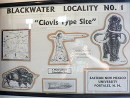
Blackwater Draw Museum
On the way to Roswell, I read Fodor’s Guidebook. Fodor insists that you stop at Blackwater Draw Museum, a lonely little museum situated between the little towns of Clovis and Portale in Northeastern New Mexico. I obey Fodor’s 4-star rating and we find an amazing archeological sight. At the museum, we get our orientation (the actual digs are down the road a few miles). An enthusiastic, knowledgeable graduate student at the front desk takes our $2 Senior Admission fee and gives us an overview of the place.
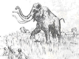
Blackwater Draw is indeed a BIG DEAL. It's the site of the oldest known culture in North America. The Clovis people of Blackwater Draw, New Mexico lived here 11,300 years ago. Clovis are named from the nearby town. They probably migrated across the Bering Strait down through Alaska and into New Mexico. They lived among Columbian Mammoths, saber-tooth cats, four-tusk mastodon, dire wolves and giant sloths.
The Clovis men were great hunters (while their better halves gathered berries, I'm sure). They were great prehistoric engineers and furthered tool and weapon technology. The place was cluttered with their stuff and and huge pits of animal bones. Because of the distinctive Clovis-designed arrowheads with fluted points, archeologists know the Clovis man dominated the scene in these parts. However, in spite of an abundance of animal bones, not one human remain has been found. Was this just a popular hunting and rest stop? Are the bodies buried in an old Indian burial ground?
Speculation is that the place must have been some huge butcher shop, a pit where the Clovis brought the trophies from their hunts. One exhibit shows a point from a spear sticking in the rib cage of a mammoth that had probably wandered into the area to drink from the famed water hole.
And why was life so abundant here – WATER, of course. Blackwater Draw was a drainage channel during the Pleistocene period and full of streams and flowing water. Animals and man were drawn to the Blackwater Draw because of water -- like the rest of the world.
Sadly, the pond dried up about 7,000 years ago, and the area gradually turned from forest into prairie and then desert. The humans actually dug wells by hand (and developed clever tools to do the job). However, when the water supply dwindled, the animals went thirsty. Lacking the ability to adapt like the humans -- and survive human attacks -- they slowly died out. Once the animals were gone, the people wandered off in search of food. Blackwater Draw was abandoned, leaving behind this rich archeological dump.
Archeologists have dug down through 18 feet of sedimentary strata. Buried in the layers of human settlement were four groups of people that called this place home:
- Clovis (radiocarbon dated between 11,600-11,000 years before the present)
- Folsom (10,800-10,000 years BP)
- Portales (9,800-8,000 years BP)
- Archaic (7,000-5,000 years BP)
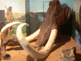
Bill and I wander through the small, unimpressive museum, but behind each dusty display case is a real find -- stone and bone weapons, tools, butchering implements used for processing the animals and fossilized bones of the animals that roamed here including extinct forms of elephants, wolves, bison, giant turtles, large horses, giant ground sloths, short-faced bears, camels, Columbian mammoths, and saber tooth cats.
Welcome display
Huge Head of a Columbian Mammoth
|
Simple Displays |
Backwater Draw was first discovered in 1929 (A.D.) by a fourteen-year-old kid, Ridgely Whiteman, and a bunch of his buddies. Roaming the hot, dry plains with thick patches of wiry grasses, Ridgely spotted several "points," or spearheads, sticking out from the earth. He sent one of the points to the Smithsonian Institute along with a mammoth tooth fragment. It took a couple of years for the Smithsonian to get back to him, but when they did, he was credited with discovering the site of the oldest known culture in North America.
Full-scale excavation began, along with intermittent struggles with the New Mexico State Highway Department. The road-guys opened a gravel pit in Blackwater Draw to supply gravel for road construction between Clovis and Portales. The Archeology Guys fought the Gravel Guys. Archeologists were finally able to close the pit in 1979. On a brighter note, years of digging up gravel turned up numerous animal bones. The area is now referred to as archeological site Blackwater Locality No. 1. (Eastern New Mexico University owns and manages the excavations and visitations at the site. Blackwater Draw was declared a National Historic Landmark in 1961.)
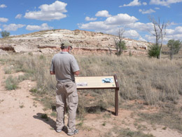
After filling our brains with the information at the museum, we drive down the road to explore Blackwater Locality No. 1, once an extinct riverbed near Clovis. We walk down a self-guided path into the depths of the former quarry operations. It’s not very impressive – just a big old pit.
None of this looks very impressive from the dry and dusty trail. The hard ground is interspersed with harsh, wiry plants and scrubby bushes and trees. The trail markers on the self-guided tour speculate “what may have happened” thousands of years ago. With the abundance of hunting tools, animal bones, and other artifacts littering the place, it's easy for archaeologists to formulate theories of everyday life for these early Americans. I study each little outcropping in the ground hoping to find a spearhead – but I didn’t spot any.
Blackwater Draw - Self Guided Path |
Beautiful, But Tough |
A large windowed shed protects the past and current excavations and a smaller shed protects a Clovis-period hand-dug well, one of the earliest water control systems in the New World. (There were once at least twenty wells on site).
We enter a large metal shed protecting the neatly excavated layers of strata (starting at 15 feet below the modern surface) and finally get the significance of this place. We gawk in silence at some 11,000 years of history -- only a fraction of which has been uncovered.
 Columbian Mammoth |
We head on to Roswell with scenes of extinct animals dancing in our heads.
It isn’t long until we are on the northern outskirts of Roswell with mile after mile of fast food joints, plastic motels and Super WalMarts. When we passed through the heart of town and are surprised to discover the wonderful old buildings and a grand old neighborhood with stately houses on tree lined streets. However, only a few miles and we pass through this time warp and are back to tacky junk development that progress has engendered.
We find our Ramada motel that was highly recommended. (Somebody needs to update that travel guide.) It was an “OK” place, but cried out for a remodel and the guy at the front desk had no personality whatsoever! We find our room, unload the car and have a beer, searching for a news channel.
After a brief rest, we drive back to the old downtown area and find a good Mexican restaurant (El Bravo Toro). The fajitas and tacos are very good, but we have a long wait. A huge group is seated before us. A couple of motorcycle guys vie for the attention of our waitress. She loves flirting with them while she ignores us old farts. We are glad to get the check and get out of there. Roswell is way weird. We stop and buy a phone call and go back to our motel to “phone home.”
Tuesday, May 26 – Roswell to Alamogordo
We eat a continental breakfast at the so-so Ramada. I take extra bagels and cream cheese for lunch down the road.
At 8:30ish, we stopped in at the Visitor’s Center in Roswell where a very friendly host takes our photos with the aliens. (He probably just returned from a rah-rah customer service training workshop – a little too friendly for our taste, but then, again, maybe he’s an alien.)
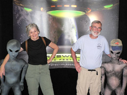
Welcome to Roswell |
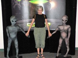
Nancy and Pals, Welcome Center |
After our official greeting and photos with the aliens, we take a little walk in the neighborhood behind the Visitor’s Center to kill some time before the Roswell Museum and Art Center opens at 9.
Roswell Museum and Art Center
Small, but lovely, the Roswell Museum and Art Center opened in the 1930s – thanks to the city government, local archaeological and historical societies, and the Works Progress Administration (WPA).
Roswell Museum and Art Center |
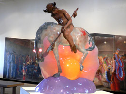
Luis Jimenez, The End of the Trail With Electric Sunset, 1974
|
The gallery is beautifully done. There is a little side room loaded with the works of Peter Hurd and his wife Henriette Wyeth. (More about Peter and Henrietta later down on the road.) We only found one Georgia O'Keeffe – but that’s OK, we’re not crazy about G. O’Keeffe’s.
We venture through a section of the early historical – Indian baskets, pottery, and weapons (swords and such used by the conquering) – Yes, there’s always weapons.
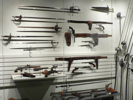
Lots of Weapons |
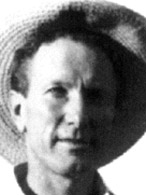
Robert Goddard
The really big exhibit is reserved for Robert Goddard - " Father of American Rocketry" and one of three pioneers that opened up the way for space exploration. Bill knew all about Goddard and his rocket wizardry, but until I stumbled across this museum, I knew nothing of the man. It turns out that Robert Hutchings Goddard is as responsible for the dawning of the Space Age as the Wright Brothers were for the beginning of the Air Age. He gathered more than 200 patents, many of which were issued after his death.
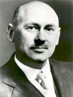
Robert Goddard |
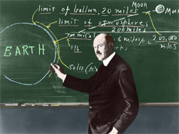
Robert Goddard and His Theories |
A few facts are in order:
Robert Hutchings Goddard, Ph.D. (October 5, 1882 – August 10, 1945)
Professor and scientist, pioneer of controlled, liquid-fueled rocketry.
Goddard was born in Worcester, Massachusetts. He was a thin and frail boy who suffered from pulmonary tuberculosis. He was a voracious reader and probably a real geek. He read the science fiction classic, “The War of the Worlds,” by H. G. Wells which fueled his fascination with space. He was interested in fireworks, kites and balloons. At 16, he attempted to construct a balloon made with aluminum. He shaped the raw metal in his home workshop. The balloon experiment didn’t work, but that didn’t deter him.
In 1908, he received his degree in physics from Worcester Polytechnic Institute and then entered graduate school at Clark University where he earned his master's degree in 1910 and then went on to receive his doctorate a year later.
While an undergraduate at Worcester Polytechnic Institute, Goddard wrote a paper outlining some of the first breakthroughs in developing gyroscopes.
Smithsonian gave him a grant of $5,000 to study rocketry. His work resulted in the predecessor of the World War II bazooka. However, armistice came only four days after the demonstration and canceled all Army interest in Goddard and his rockets. It was not revived for 26 years.
The newspapers discovered him and tried to make him famous with his ideas of hitting the moon with a rocket, but Goddard didn’t care for the publicity.
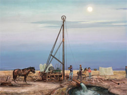
Goddard launched the world's first liquid-fueled rocket on March 16, 1926 from a farm near Auburn, Mass. Esther, his young wife of 2 years, was present at the event as the official photographer. The rocket reached an altitude of 41 feet and a range of 184 feet and traveled the distance in only 2 1/2 seconds. It was not a statistically impressive performance, but neither was that at Kitty Hawk, N. C., on Dec. 17, 1903. He was ridiculed for his theories and received little recognition during his lifetime.
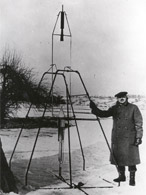
Liquid Oxygen–Gasoline Rocket
March 16, 1926, Auburn, Mass
|
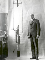
Goddard - first liquid propelled rocket, 1925
(He is s a Rocket Scientist.)
|
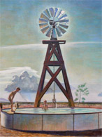
In 1930, Goddard needed more room and a milder outdoor climate for his experiments, He moved to New Mexico, near Roswell. His Mescalero Ranch was only 100 miles from the White Sands Missile Range. There, in a well-equipped machine shop, Goddard designed and developed liquid-propellant rockets that were the direct ancestors of the Saturn 5 and Titan 3C space boosters of the 1960s.
In 1932, Goddard launched a rocket with a gyroscopic stabilizer in New Mexico. In that same year, because of the economic depression, Goddard returned to Clark University to continue his research and survive on the several patents that grew out of his work in New Mexico.
Later, he returned to the ranch in New Mexico. His rockets grew larger and flew higher. On March 31, 1935, a 15-foot-tall model reached an altitude of 7,500 feet under gyroscopic control. Goddard's research continued here until 1942.
He had throat cancer and died in 1945 in Baltimore, Maryland. He was buried in Hope Cemetery in his hometown of Worcester, Massachusetts. |
Goddard’s entire workshop is re-created in the museum. We walk through the actual engines, rocket assemblies, and specialized parts Goddard developed in the 1930s when he worked in Roswell – pretty amazing stuff.
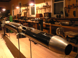 Goodard's Workshop Recreated |
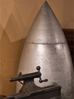
More Workshop |
UFO Museum
We leave the Roswell Museum and Art Center with our brains stuffed with rockets and head to a shabby little UFO museum in the heart of Roswell -- The International UFO Museum and Research Center. It is located in the old Plains Theater on Main Street. (A brand new museum is being planned – UFO’s are big business in Roswell.)
Reluctantly, Bill pays the entrance fee and even pops for the extra audio guide. The people at the front desk seem normal enough, but the displays and alien creatures are very stupid.
First, a little background
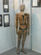
On July 8, 1947, a local rancher, Mac Brazel, found unusual debris scattered across his property. The U.S. military released a statement saying the wreckage was from a spaceship crash. However, four hours later, the military retracted the statement, claiming what fell from the sky was "only a weather balloon."
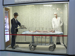
Most of the community didn't believe the weather balloon story. They believed that the crash involved two spacecraft. One disintegrated, leaving the debris across the Mac Brazel ranch. Eyewitnesses to the account, swear that the debris "was not of this world." The spacecraft was a crash-landing with four alien bodies inside (which the military carted away to examine).
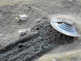
Re-enactment of Flying Saucer Crash |
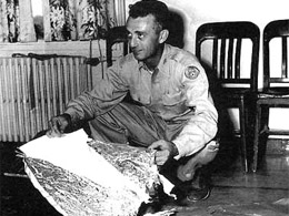
Local law enforcer shows evidence of the spacecraft landing (circa 1947) |
The town folks (and farmers alike) were suspicious of the military. This place was, after all, rooted in space happenings and top secrets -- Robert Goddard had been working on rockets in this area since the 1930s, and the Roswell Air Base was nearby.
The most recent comment from the Air Force came in 1997, two weeks before the 50th anniversary of the "crash." The Air Force said that the unverified aliens were life-size dummies dropped from the sky during a series of experiments in the 1950s.
UFO advocates don’t believe the U.S. Air Force's weather balloon story for a minute. They insist there were actual "alien bodies." The whole purpose of the UFO Museum and Research Center is to rebuff the military’s account.
We walk through the displays while our audio guides give an hour-by-hour, blow-by-blow account of the "incident." We see lots of maps, yellowing newspaper articles and taped eye-witness accounts to disarm the “army cover-up.” The museum doesn’t lack for bizarre photographs of elaborate crop circles.
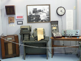 Latest Technology Tracking the Incident |
Weather Balloon Dummy |
The final exhibit is an alien prop featured in the Showtime movie “Roswell” which leaves you wondering – Why did I pay good money for this?
From the Movie "Roswell" |
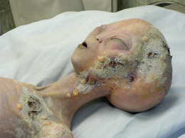
Alien from The Crash |
We return our rented headphones and leave the parking lot immediately. We make the mistake of circling back 10 miles to WalMart Super Store to save a few bucks on beer and a couple of t-shirts.

WalMart, Roswell |
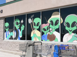
Aliens Everywhere |
We woofed down our pilfered bagels and cream cheese en route to our next stop, Hurd-La Rinconada Gallery in San Patricio, 50 miles away. We go west on Highway 70 for about 50 miles past the community of Hondo, in the beautiful Hondo valley at the confluence of the Rio Hondo and Rio Bonito. We travel another 4 or 5 miles to the small community of San Patricio and follow the signs to the Hurd-La Rinconada Gallery, tucked out in no man’s land.
Hurd-La Rinconada Gallery, San Patricio |
Hurd-La Rinconada Gallery
This place is definitely Peter Hurd country. We previewed Peter and wife Henrietta’s work this morning at the art museum in Roswell so it is a very special treat to see the land that inspired them.
Peter Hurd's Country |
Another Hurd |
We find the ranch house tucked way out in the country. (Fodor travel guide gave it a star.) The place showcases the original works of Peter Hurd, Henriette Wyeth Hurd, Michael Hurd, Andrew Wyeth and N. C. Wyeth.
When Peter and Henrietta Hurd raised their four children on this ranch. Famous authors, movie stars and other artists were constant guests at the Hurd ranch, sitting for portraits, playing polo or just enjoying the creative atmosphere that that the Hurds generated.
A proper, well-dressed, middle-aged cultured lady greets us at the door. She tries to entice us to stay at the upscale Bed and Breakfast, part of the complex. (It’s way too upscale for us and we’re not B&B types.) She shows us around. We learn about the famous artists Peter Hurd and wife Henriette (Hurd) Wyeth and their clever artist son, Michael Hurd, who is the genius behind the place. We are free to roam from room to room and piece together their amazing life here.
Cast of Characters:
Peter Hurd - 1904 - 1984
Peter Hurd |
Cowboy |
War Correspondent |
Peter Hurd left his birthplace of Roswell, New Mexico in 1921 to attend West Point. He flunked out of the academy after only two years and was determined to become an artist. Peter sought out the great N. C. Wyeth in Chadds Ford, Pennsylvania and studied as his private pupil for the next ten years.
Peter fell in love with N. C. Wyeth's oldest daughter Henriette. They married in 1929 and against her father’s wishes, the young couple returned to New Mexico to live out their life together. They raised four children on their San Patricio ranch.
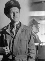
During World War II, Hurd worked as a war correspondent for Life Magazine, and was stationed in England. He traveled extensively and covered WW II for Life Magazine.
In 1967, Hurd was commissioned to paint the official White House portrait of President Johnson. The finished portrait was rejected by LBJ and now hangs in the Smithsonian's National Portrait Gallery in Washington, D.C. Hurd is best known for his watercolors, temperas and lithographs depicting the New Mexican landscape he loved. He died in 1984 in Roswell.
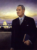
That's the ugliest thing I ever saw! – LBJ |
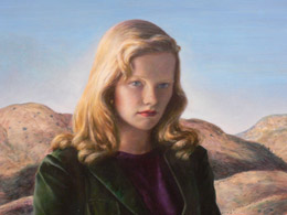
Hurd's Portrait of daughter Peggy, 1948 |
Hurd's Portrait of wife Henriette, 1948 |
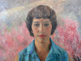
Henriette Wyeth Hurd, Wife of Peter Hurd- 1907-1997
Henriette Wyeth Hurd |
Henriette was the first child of the famous illustrator N. c. Wyeth. She is considered by many to be one of the great women painters of the 20th century. At age eleven, she began studying art with her father, N. C. Wyeth. She contracted polio that crippled her right hand. Even so, as a teenager, she held a paintbrush between her first and second fingers and developed into a fine portrait artist.
She married Peter Hurd, her father’s student. After their wedding, (and against her father’s wishes), Henriette and Peter moved to Sentinel Ranch in San Patricio, New Mexico. Henriette is still today the only Wyeth to leave the east coast. She immediately settled and loved her new primitive, arid, harsh dusty surroundings.
She became the matriarch of the Wyeth Hurd Family. She was commissioned to paint well-known subjects such as First Lady Pat Nixon, actress Helen Hayes and author Paul Horgan.
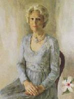
Pat Nixon's official White House portrait
, 1978 |
Michael Hurd, 1946 – (youngest son of Peter and Henriette Wyeth Hurd)
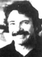
Michael Hurd |
Michael Hurd, a graduate of Stanford, had a brief musical career performing with the Kingston Trio. After several years in the real estate business in Chicago, he returned to New Mexico where he studied painting with his mother, Henriette.
Michael oversees the operation of the Hurd ranch in San Patricio, New Mexico, where he lives . Michael is now a painter in his own right and was named New Mexico's Distinguished Artist for 1995. Just as his parents did throughout their lives, Michael paints and lives on Sentinel Ranch.
Lost Trail at White Sands by Michael Hurd |
Newell Convers (N. C.) Wyeth - 1882-1945
(Henriette Wyeth Hurd's Father, patriarch of three generations of Wyeth-Hurd artists and Peter Hurd’s teacher)
N. C. Wyeth |
N. C. Wyeth is best known as an illustrator and his images appear in children's classics, tales of adventure, historic and patriotic poems, and magazine stories.
N. C. was born in the rural town of Needham, Massachusetts. He did poorly in school and spent much of his free time sketching. In addition to his popular commercial art, he also created a number of impressionistic paintings of the Pennsylvania countryside and the land around his summer home in Port Clyde, Maine.
Wyeth married Carolyn Bockius of Wilmington, DE in 1906 and settled in nearby Chadds Ford, Pennsylvania where he built a home and studio overlooking the historic Brandywine Valley. The Wyeths had five children: Henriette, Carolyn, Ann, Nathaniel and Andrew. Andrew is himself a noted American painter.
Illustration by N. C. |
Andrew Wyeth - 1917 - 2009
(N. C. Wythe's youngest son; brother of Henriette Wyeth Hurd)
Andrew Wyeth |
Andrew Wyeth is the most acclaimed artist in the family. He has been recognized internationally as America's foremost realist. Andrew was close to his father and began studying with him at an early age. He never attended school although he had a tutor. N. C. felt that the years most children spent in school were the most critical time for an artist to perfect his craft, to absorb and learn, to “see” as an artist. As a child, Andy spent a great deal of time alone in the woods surrounding his family's home in Chadds Ford, wandering and exploring.
Andrew Wyeth’s most famous painting “Christina's World”, hangs in the Museum of Modern Art in New York.
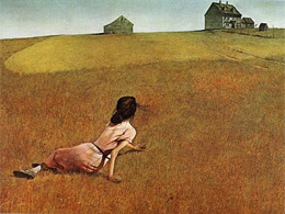
Christina's World
by Andrew Wyeth, 1948 |
|
We finish exploring the quiet gallery filled with this legendary family’s treasures. Just as we are leaving, our proper host informs us that signed (or unsigned) reproductions are available. We thank her (and say “no thanks”) and then say good-bye.
Raindrops start to fall as we race to the car and then retrace our steps from San Patricio, east on US 70 for 4 miles to Hondo. We turn west onto US 380 for about 10 miles to Lincoln, a fascinating little town that is a National Historic Landmark. The New Mexico countryside around here takes my breath away with its rolling hills, small mountains and mesas dotted with trees and plants. The little town of Lincoln is nestled right snack dab in the center of this beauty.
I am very excited about visiting Lincoln, the toughest town in the West. The legend of Billy the Kid fascinates me. Billy is a homey from Lincoln, now Lincoln State Monument, a National Historic Landmark made up of eleven well-preserved historic adobe and stone buildings.
We arrive in Lincoln and go directly to Visitor's Center. An enthusiastic ranger greets us. She was once a teacher and wants us to learn all about the town and Billy the Kid. She said Billy the Kid was a poor, fatherless, pimply-faced ner-do-well teenager, not much to look at, but liked the woman -- so much for my image of Bill the Kid.
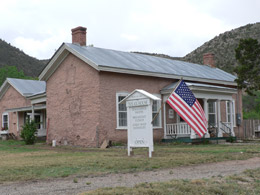
Visitor's Center, Lincoln |
The guide gives us a map and tells us the orientation video starts in 15 minutes in the old-fashioned theater. We roam about the museum and learn a little of Lincoln’s history with Apaches, Hispanics, Anglo cowboys, Buffalo Soldiers, and the details of Billy the Kid and The Lincoln County War.
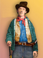 Billy the Kid |
 The Real Billy the Kid |
Lincoln, A little History of the Place:
For eons (up until 1849), Native Americans roamed the area that would become Lincoln. Then comes the Spanish Pioneers who settle the lush green valley of the Rio Bonito. In 1869, Lincoln County was formed and the fledgling settlement became the new County Seat. It was then when the town’s name was changed to Lincoln, to honor Abe Lincoln. Lincoln developed a reputation for violence and easy treatment of offenders. Gambling and prostitution were commonplace and whiskey was sold to Indians, soldiers and anyone who could lift a bottle.
The county and the town were populated by a number of cattle barons and cowboys, in addition to the Spanish settlers. In the early 1870's two men, Lawrence Murphy and James Dolan, owned the only store in Lincoln County, the largest county in the nation, covering one-fifth of New Mexico territory. These guys were powerful. They not only owned Murphy & Dolan Mercantile and Banking, they also owned large cattle ranches, and had influential territorial ties to officials in Santa Fe. They were able to obtain several lucrative contracts with the military nearby at Fort Stanton.
Before long, Murphy and Dolan monopolized the trade of the county, controlling pricing, making huge profits on their goods, and virtually having a hand in nearly every part of the economy of the large county. The merchants, along with their allies, who included local law enforcement, became known as “The House.”
For obvious reasons, Murphy and his allies were disliked by the small farmers in Lincoln County, who were forced to pay high costs for their goods, while at the same time, accepting low prices for their cattle.
In 1876, a rival store, called H. H. Tunstall & Company, was set up by Alexander McSween and John Tunstall. As one might imagine, this really pissed off the powerful Murphy and Dolan (and both ended up slain). This feud between the two factions for political and economic control of the area lasted for two years ( 1878-1881) and became known as the Lincoln County War. The violent war killed quite a few men and made pimply-faced Billy a legend. Lincoln was the true wild west with its Indians, Mexican American settlers, gunfighters and corrupt politicians. Sometimes, the feud was fought in the courtrooms, but more often through cattle rustling, gunfights, and murder. All of it came to a head when John Tunstall was murdered on February 18, 1878.
Billy the Kid, who had been employed by Tunstall as a ranch-hand, soon formed a gang, referred to as the "Rustlers" or simply Billy the Kid's Gang, to fight the evil Murphy and Dolan. Billy the Kid became a fugitive and survived by stealing and rustling cattle. Sheriff Pat Garrett, aligned with the Murphy and Dolan faction, actively pursued Billy and his gang, especially after Governor Wallace put a $500 reward on his head in December, 1880.
Garrett and his posse finally captured Billy the Kid and his gang of "Rustlers" on December 23, 1880. After a trial in Mesilla, New Mexico in April, 1881, Billy was taken to Lincoln, where he was scheduled to be hanged on May 13th. However, Billy escaped on April 28th, killing both of his guards while Garrett was out of town. It would be his last escape; however, as Garrett tracked him down at Fort Sumner, where he shot and killed the teenage outlaw on July 14, 1881.
During Lincoln's violent heyday, more than 450 people made their homes here. When the town calmed down, Lincoln continued to serve as a supply center for area ranches and mines and by 1888, had a population of about eight hundred. However when the railroad moved to nearby Carrizozo, the population dropped and by 1909, Lincoln lost its county seat status to Carrizozo.
Currently, only about 75 residents live here. However, many of its old buildings are well-preserved. Today, the old settlement is officially referred to as the Lincoln State Monument and the most widely visited state monument in the state. |
A Walk on the Streets of Lincoln
Somewhat hyped from the Visitor Center, we take the map and explore the town. The adobe architecture historic buildings line both sides of Lincoln's mile-long Main Street. The gurgling Rio Bonito River forms the northern boundary of the town. There are few commercial gas stations or convenience stores to mar the original face of the town. In fact, many of the homes are marked “private” so tourists will not intrude.
We walk in the footsteps of Sheriff Pat Garrett, Billy the Kid, and other infamous characters involved in the violent Lincoln County War and I imagine what it was like here as a settler dealing with gunfighters and corrupt politicians.
Turns out that many of the sights to see in the tiny landmark town are closed, so we dashed up and down the main street, in and out buildings, trying to cover all of the sights as the big storm clouds are moving in.
We stop at the Old Post Office (which was closed) and the Tunstall-McSween Store (built in 1877) now a museum with displays of the original 19th-century merchandise in the original shelving and cases. This store was once a focal point in the Lincoln County War and both of the partners were slain. (The guide seated at the door is more interested in discussing sump pumps with the locals than dealing with the few straggler tourists that find their way into Lincoln.)
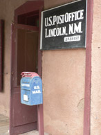
Lincoln Post Office |
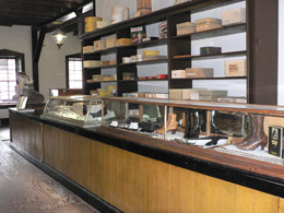
Tunstall-McSween Store |
The San Juan-Bautista Mission is a well preserved building that still serves parishioners today. The old Mason’s meeting hall is a curiosity. I wonder what kind of deals were hatched here in the secret brotherhood.
The Old Dolan House was built in 1888 by J. .J. Dolan. (Dolan took part in the feud on the Murphy side.) We are fascinated by the old watchtower, the Torreon, built in the 1850’s. It was one of Lincoln’s earliest structures. Its thick walls protected Spanish-Americans against the Apaches. In the Lincoln County War, Murphy’s sharpshooters were stationed here on the lookout for Billy the Kid and his gang.
Dolan House |
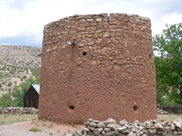
The Torreon |
We pass by (without photographing) a few stores, the Wortley Hotel , the ruins of a bar and a hotel, Dr. Wood's house and several residents’ houses clearly labeled “Private.” The Wortley Hotel, was owned by Sheriff Pat Garrett. It was here that Deputy Ollinger had his last supper before Billy the Kid shot him and Deputy J. W. Bell down.
We save the best for last -- the old Lincoln County Courthouse on the west end of Main Street. The courthouse is now a museum, which highlights Billy the Kid's escapades and his escape complete with a famous bullet hole he made during his flight. We see the courthouse and the iron shackles that held Billy the Kid (sorry, my picture came out blurry). We walk out back and view the markers designating the spot where the two Deputy Sheriffs, Ollinger and Bell, were gunned down by Billy the Kid in his escape.
The storm clouds roll in and raindrops start to fall so we dash to our car and drive a few miles west on 380 to Ft. Stanton. (I’m a sucker for old forts.) Ft. Stanton was built in 1855 as a frontier outpost to protect American settlers from Apache raids and was active until 1896. Kit Carson was once in charge at the fort. The fort also served as a major market for agricultural goods, making the settlers (both Hispanics and Whites) in the Hondo Valley prosperous by farming, herding sheep, goats and cattle. At the turn of the century, Ft. Stanton became a US Merchant Marine hospital for tuberculosis. Across the road was a big military cemetery -- the only inland Merchant Marine Cemetery in the U.S. We find the fort in the heavy rainfall. All the buildings are locked up and nobody is to be found. We do what we can -- regroup and move on to Plan B.
NOTE: Because of the weather, we missed a couple of things --
Capitan and Smokey Bear Historical Park -- where Smokey was born. In the early 1950's, firefighters found a singed, orphaned cub and our national symbol of forest fire prevention was born.
We also missed Carrizozo, the Lincoln County seat since 1912 (and where, we are told, the best green chili cheeseburgers in the Southwest can be found). The biggest disappointment was not getting to see Valley of Fires Park or the Three Rivers Petroglyph site. Instead, we headed for Ruidoso and an indoor activity – the famous Hubbard Western Museum.
Hubbard Western Museum
We drive south on 37 and into Ruidoso, a once quaint mountain community that became a popular ski resort and then, was ruined by schlock that growth often brings. We drive by the famous Ruidoso Downs that has seen better days. The sun is breaking through as we make our last stop of the day, the Hubbard Western Museum. The displays are nice. . .mostly early transportation (horse, wagons and buggies) and some early mining items. We are tired and don't get too excited about the collections. However, we are fascinated about the wealthy, rebellious gal, Anne C. Stradling, who gave her vast horse-related collections to the museum.
Anne C. Stradling
Anne Schley was born on March 1, 1913 in New York City to a wealthy family. She spent her early years in a refurbished country farmhouse where she grew to love horses. She was less than a year old when her mother rode with her on a horse named “Sweetness.” At six she participated in her first horse show aboard a pony named “Robin,” and at the age of seven she won her first hunter race in Far Hills.
Anne began her own collection of horse-related items as a young girl and from those beginnings came a collection in excess of 10,000 horse-related items.
At the age of 20, Anne Stradling turned her back on the high society life and married her first husband, Jack Webb — a rodeo cowboy and trick-roper in the world-renowned 101 Ranch Wild West Show. They moved to the famous 101 Ranch in Oklahoma, where daughter Jean was born. While in Oklahoma, Anne learned to trick ride and rope calves, and competed in rodeos.
After 12 years, the marriage ended. Following her divorce from Webb, and a second marriage and divorce, Anne moved to Tucson, Arizona. There, she introduced fox hunting to reluctant group of horsemen in Arizona. She later married Floyd Stradling, an Arizona rancher and well driller. Together they took Anne’s vast collection and created the Anne C. Stradling Museum of the Horse in Patagonia, Arizona in 1960. In 1989, due to failing health, Anne Stradling contacted the Hubbard Museum about a permanent home for her massive collection in Ruidoso Downs, New Mexico. Anne Stradling died February 26, 1992 in Tucson, Arizona. |
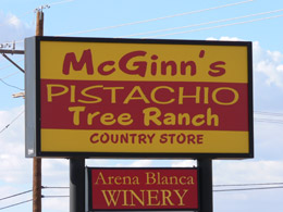
We emerge from the museum with the sun once again shining. We drive south on 70 to Alamogordo and stop at McGill’s Farm, famous for wine and pistachios. The song, “Go Away Little Girl,” is playing in the store and stirring up memories of my early years. The aging gal at the counter, who is not quite right, offers us an assortment of free pistachio candies in a variety of flavors - Roasted and Salted, Red Chili Flavored, Green Chili Flavored, Garlic Flavored, and Lemon-Lime Flavored. We are hungry and dive in ... and leave with 4 large bags of pistachios.
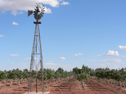
Vineyards and Pistachio Trees |
The Big Sign in the Sky |
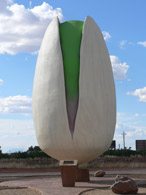
A Giant Pistachio |
|
Finally, weak from all the adventure, we find our way to Alamogordo, made famous on July 16, 1945, when the first atomic bomb was exploded at nearby Trinity Site. I think the place should be called "Alamageddon," because it’s very sad -- filled with acres of desolate motels and fast food places interspersed with super-sized WalMarts choking out a once lovely little town. Because of all the schlock, one hardly notices the magnificent town setting (mountains and cliffs in the background sweeping down into the flat valley.)
After a few inquiries, we land at a Motel 6. Room’s clean and quiet – but no internet, no shampoo, no hairdryer. We kick up our feet and have a beer and prepare ourselves for a big night on the town.
We drive into the old town section of Alamogordo (and along New York Ave. where you can get anything you can get in NYC – now that’s a big joke). We pick Margo’s Mexican restaurant for dinner. I go crazy over my chicken breast baked with a chili and cheese. Wonderful, fresh food. I am really hungry.
We come straight back to our motel and call home. We’re really missing Zion – but no real time to talk, the calling card we bought in Roswell for 500 minutes is only good for about 45 minutes!
I catch up in my journal while Bill snoozes.
Wednesday, May 27 – Alamogordo to Deming
We eat some cereal in the room so we can be on the road early – lots to see today. Because the forecast calls for afternoon showers, we decide to do “White Sands National Monument” in the morning while it’s bathed in bright blue skies. We head 370 south for 10 or 15 miles and then turn on Dunes Drive right at the Visitor’s Center. From the Visitor’s Center, there is an 8 8-mile scenic drive, named Dunes Drive, that goes through the park, stopping at trailheads along the way and ending at Heart of the Sands, where folks come to slide down the dunes and play in the sand.
White Sands National Monument
We drive through the glistening white sands. The monument covers 275 square miles of desert and is one of the world’s great natural wonders. The “sand” is not really sand, but gypsum and this is the largest gypsum dune field in the world. The common mineral gypsum, hydrous calcium sulfate, is rarely found as sand because it is soluble in water.
Rain and snow in the surrounding mountain range dissolve gypsum from the rocks and carry it to the Tularosa Basin. No river drains the Tularosa Basin so the water, with the gypsum and other sediments, is trapped there in Lake Lucero. Here, it crystallizes and pushes up in quartz from the bottom of the lake. Along Lake Lucero’s shoreline and in the Alkali Flat, beds of crystals, some three feet long, cover the ground. The crystals dry and freeze and heat up and eventually break down into sand-size particles light enough to be moved by the powerful southwest wind. The pieces tumble and are further filed down into fine particles, like sand, covering everything in its path.
Within this extremely harsh environment of the dune field, even plants and animals that have adapted to desert conditions must struggle even harder to survive. Only a few species of plants grow fast enough not to be buried by the monster moving dunes. Several types of small animals have evolved into white coloration to camouflage them in the gypsum sand.
We stop to take a one-mile loop trail (Dune Life Nature Trail) that winds through the edge of the white sands. Life is most abundant here in the dunes. It is early in the day and the sand (oops, I mean gypsum) hasn’t been disturbed by human souls (or the soles of their shoes), so we can easily spot many footprints left by birds, reptiles and animals. During the hot days, wildlife in the desert mostly stays underground in burrows, coming out at night. Lizards, beetles and birds, active in the day, can be seen in vegetated areas. It is a fun trail with illustrations of the tracks (e.g., rodents, rabbits, foxes, coyotes, porcupines) posted on the trail markers to show you what critters are out and about.
We drive to the next trail and explore the Interdune Boardwalk – an elevated boardwalk built for wheelchairs and strollers. However, there is one flaw in the design of the boardwalk -- the material used to construct the boardwalk is electrifying. Everyone is so afraid of getting shocked when they touch the rail that they paid little attention to the plants below.
The trail leads you above the fragile interdune area – where all plant life in the dune field starts. The area is covered by the darker, crunchier, bumpy surface in the dunes called the crypto biotic crust. The boardwalk takes you above this interdune crust to protect the delicate plants. When I think I’m safe from the occasional electrical shock, I get some nice close-ups of the plant life below.
Interdune Boardwalk |
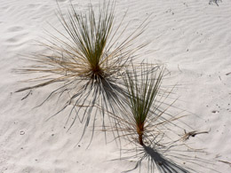
Views from the Boardwalk |
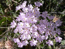
Color on the Trail |
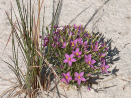
More Color on the Trail |
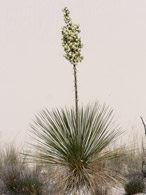
Yucca |
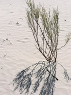
Me and My Shadow |
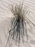
Me and My Shadow |
We get in our car and drive to the Heart of the Sands – a place where the park invites people to play in the sand. We see some school kids dragging "sand sleds" up the hill. Looks like so much fun.
Great Day for Sand Sliding |
Heart of the Sands |
We stop and have lunch at the weirdest picnic area – looks like something from Star Wars. Jet fighters roar overhead and shake the entire picnic table. It is a strange experience. We are the only picnickers.
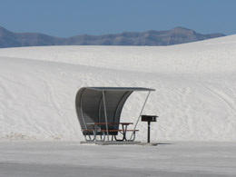
Strange Picnic Table |
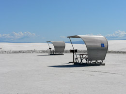
Heart of the Sands Picnic Area |
We go to the Nature Center, a small trailer building in the park that display a few exhibits of the animals and plants. We talk to Cliff, the ranger and learn how gypsum is formed. Cliff tells us gypsum does not transfer heat and is very cool to the feet, not at all like one would expect from the bright white sands. He invites us to do the Alkali Flat Trail and do it barefooted. I’m game.
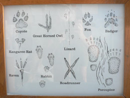
Track Display at the Nature Center |
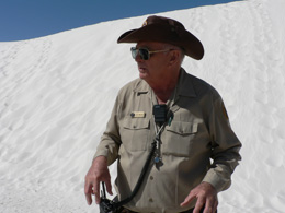
Ranger Cliff |
The Alkali Flat trail is 4.6 miles round trip. We are sorry we don’t have time to do the whole trail. It takes you through the Heart of the Sands, up and over dunes and ends at the edge of the Alkali Flat. (Alkali Flat is the dry lake bed of Lake Otero that covered 1,600 square miles before the last Ice Age.)
We manage to hike in about 2 or 3 miles and see some spectacular dunes (with very few plants) and beautiful vistas. The trail is marked with orange reflective tape at the top of posts scattered about the dunes. After you find one marker, you look for the next before continuing. The desert can be unkind (especially without a GPS). Unfortunately for us photographers, the sun is directly overhead and doesn’t cast dramatic shadows in the soft dune formations – so my shutter finger is easily restrained.
As I am walking barefoot in the sand, a German tourist approaches me in shock and awe – thinking no one can walk on such hot sand. I tell her Ranger Cliff said it was OK. She thanks me and then takes off her shoes and dances off a long the trail. It is a great trail, following orange markers from dune to dune. We are sorry we didn’t make it to Alkali Flat – next time.
We drive back through the town of Alamogordo to go to the New Mexico Museum of Space History. Bill is thrilled. This is the place to be if you’re any kind of space nut.
The New Mexico Museum of Space History occupies the "Golden Cube," a five-story building with walls of golden glass. It’s a five-story museum with space travel treasures galore -- Sputnik (the real one), America's Mercury, Gemini, and Apollo programs, missiles, satellites, rocketry pioneer Robert Goddard and my favorite, HAM (the monkey who went into space).
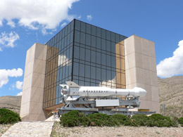
Space Hall of Fame - Golden Cube |
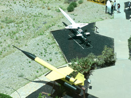
View from the 5th Floor of the Cube |
We walk around the John P. Stapp Air & Space Park, just outside the main museum to see a very impressive array of rockets, missiles and rocket engines.
NOTE: Nova / Starchaser 4 – sounding rocket was launched on November 22, 2001, in the UK. It reached an altitude of 5,541 feet and is the largest rocket ever launched in the UK.
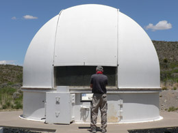
Bill with Space Travel Boyhood Dreams |
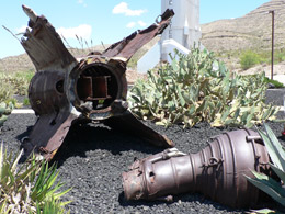
V-2 (Vengenace-2) Rubble |
V-2
What looked like a piece of rusted junk in the Space Park turns out to be a V-2 component, recovered from the nearby fields White Sands Missile Range somewhere between 1946 and 1951. The V-2 is a most interesting story. The V-2 is the forerunner of U.S. ballistic missiles and space launch vehicles (used both for defense and for early space exploration). Nazi Germany used the V-2 near the end of WW II against London, Antwerp and other allied targets. After the war, German scientist Dr. Werner Von Braun, surrendered to the Americans and was offered a contract (along with many of his colleagues) to help the U.S. Military develop the V-2 technology. Von Braun led the development of the V-2. The first group of Germans arrived at Fort Bills, Texas, in October of 1945. More than 100 German scientists and engineers were recruited for the V-2 project – and I thought it was just a piece of junk.
We walk to the museum entrance and at the front door, we find the actual Mercury capsule. Between 1961 and 1963, the first six American astronauts had a turn at going into space aboard this very one-man (one-person? One-monkey?) Mercury capsule. The seat was custom made for each astronaut. The height limit was 5’ 10”. We take turns sitting in the capsule surrounded by equipment (and very primitive looking equipment at that). Redstone rockets boosted the first two missions just into sub orbit. The more powerful Atlas ICBM propelled the other four Mercury capsules into orbit. (Bill remembers all those details from his boyhood.)
We start on the top floor to work our way down. We see a lonely guide, Charlie Farrant, who turns out to be a walking encyclopedia of space travel with first hand knowledge of all the early space programs and astronauts. I learned that he is 81 from the internet. Lucky for us, Charlie was stood up by a class of kids, so we have him all to ourselves. He tells us stories about retrieving the astronauts from the ocean (he was a frogman on the recovery team), about the wives and children, about the jokes astronauts would all play on each other. We ask him when is he going to write a book. He replies, “It’s done – just waiting for the official clearance.” We want to be the first to buy it.
Charlie Farrant - Has the Right Stuff |
Charlie shows us models of our early space ships. He points out one of the five actual Sputniks, which is hanging from the ceiling. It isn’t very impressive, but changed everything. During the Cold War, USSR beat us (US) and woke up our leaders and educators. I remember the scare and then the switch in focus on math and science. In 1958, Congress passed the National Aeronautics and Space Administration Act and thus NASA was born taking us into the space age.
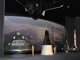
Models of Early Space Ships |
Sputnik - The Real Deal |
Charlie knew most of the astronauts and their families personally. While Bill spends his time in the Space Shuttle flight-landing simulator, Charlie walks me down the long hall of fame and tells me stories about some of the astronauts. He said when Susan Helms became the first woman in charge of her all-male crew, she picked the color pink for their official working polo shirt – so all the guys had to wear pink. They all loved her and her big hair – They really did.
Susan Helms |
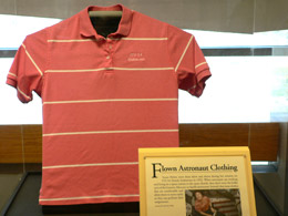
Pink Shirt Uniform for the Guys |
Some other Hall of Famers :
We see the Hawk (Homing All-the-Way Killer) surface to air missile (SAM) built to defend our soldiers on the ground against enemy missiles and aircraft. Hawk, a radar guided missile carries a conventional warhead. It first flew in 1954 and is still the most widely used SAM in the world (in terms of number of customers.
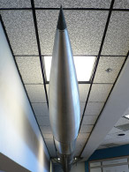
Hawk on the Ceiling |
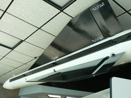
What Kind of Hawk Is That? |
We learn about the early satellite technology and marvel how computers have changed the missile technology.
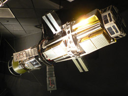
Satellite on the Ceiling |
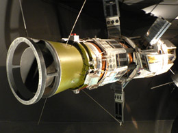
What Kind of Satellite Is That? |
We spend a lot of time looking at videos from the Ansari X Prize. The X prize, established years ago, encourages aviators to push the boundaries of flight.
We roam through one exhibit after another. Of course this is always a lot of Robert Goddard’s early ground breaking rocketry. Interpersed, we see the personal hygiene kit used by Paul Weitz on his Space Shuttle Challenger Mission (STS-6). We also see the 134 pound meteorite from Campo Del Cielo in northern Argentina. The Spaniards found the field of meteorites in 1576 and claimed credit for the discovery, but the Indians used the meteorites for centuries before as iron in making tools.
Paul Weitz's Toiletries |
Meteorite from Argentina |
About the only thing I remember about the early space exploration from my childhood is the chimpanzee and the dog (Ladka) who traveled into space. Here, I learn more about Ham (AKA Holloman Aero Med), the chimpanzee astronaut. He was born in West Africa. At 44 months old, on January 31, 1961, he made a 16-minute sub orbital flight that put him on the cover of Time magazine. Following the flight, he retired from the space program and became a resident of the national zoo in Washington, D.C. In 1980, his keepers transferred him to the North Carolina Zoo in Ashboro. Ham died there of heart and liver disease on January 17, 1983.
Sam's Suit |
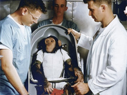
Sam and His Mates |
Ham's grave is right outside the museum. We pay our last respects on the way to the car. (I must confess, I stopped at the gift shop on the way out and fought the overwhelming urge to buy Zi a stuff monkey in a space suit. I need help!)
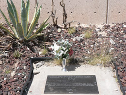
Ham's Final Resting Place |
We drive back through Alamogordo and about 50 miles west of Alamogordo on US 70/US 82. (We decide to skip Oliver Lee’s ranch. It’s too late to do any hiking.) We turn off the main highway at the sign for the White Sands Missile Range and drive another 4 or 5 miles.
It’s about 3:30 p.m. and the White Sands Missile Range closes at 4:30 – so we have just enough time for a few more missiles and rockets and yarns of space travel. We park at the visitor center near the “Check Point Charlie” gate and walk to the museum. The military guy in the booth checks our drivers’ licenses. He tells us we can only take photos of the base aimed at the mountains because many top-secret flights are going on in the opposite direction (the flat area). However the lighting was better facing the mountain ranges so I disobeyed orders. Hope I don’t reveal any top secrets.
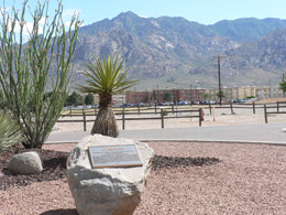
White Sands Missile Range |
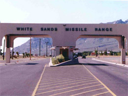
Checkpoint Charlie |
White Sands Missile Range (WSMR) is the largest military installation in the United States, with almost 3,200 square miles in area. After World War II, White Sands Missile Range was established to research that rocket technology that helped send the U.S. into space. Because of this, WSMR is sometimes known as the "Birthplace of the Race to Space". Today, the place is a multi-service test range whose main function is the support of missile development and test programs for the Army, Navy, Air Force, National Aeronautics and Space Administration (NASA), other government agencies and private industry.
We enter the large, military issued wooden building and are surprised at the eclectic collections:
- Local history of the Cowboys and Indians and Buffalo Cavalry
- Film making activities (Star Wars was filmed here - Darth Vadar and all)
- Drawings and stories from the Japanese war camps
- More Goddard rockets (That guy rules!)
- Examples of technology and experiments done at White Sands
- A small room containing artifacts from the Trinity Site. (Now the Trinity Site is open only twice a year. I still have visions of that giant mushroom cloud and dummies in that old farmhouse being hurled through the air.)
We cover the exhibits and cross the road to see an actual refurbished V-2 (Vengeance 2). Just earlier, at the Space Museum in Alamogordo, we learned all about the V-2 and the technology from Dr. Werner Von Braun and his Nazi German pals. Now we see a shiny, spiffed up V-2 with more displays and more accolades.
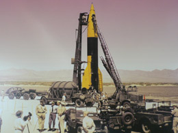
V-2 - Early Days at White Sands |
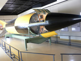
V-2 (Vengeance 2) |
It’s 4:30 and the buildings are closing, but we are free to roam in large missile park out back with missiles and rockets dating from the 1950s through the 1990s. It is surreal walking through the vast collection of weapons of death. It looks more like an art installation. All glistening in the sun, we walk by our country’s heroes -- Redstone, Fat Boy, Scud, and so on. Several of the missiles are embedded in my brain from the Viet Nam War and then there’s the Patriot missile used in the Gulf War. I am compelled to take photos (even the forbidden photos facing away from the mountain range and the testing fields).
Finally, our brains will not hold another bit of information about rockets or space or missiles. We walk back to our car just as the guys at Check Point Charlie are lowering the flag and playing the loud bugle music. It is quite a sight.
We drive about 25 miles to Las Cruces as the sun is setting in the desert. Las Cruces was named for the crosses of the pioneers traveling this area who were killed by the Injuns. It is also the home of The University of NM. With a population of about 75,000, it is packed with motels, fast food joints and super WalMarts.
From Las Cruces, we connect with I-10 and drive for another 60 or so miles to Deming, population 15,000 – and also packed with more motels, fast food joints and super WalMarts, just on a smaller scale from Las Cruces. Deming was one of the BADDEST towns in the Old West. Prisoners from Arizona were sent here on the stagecoach with a one-way ticket. Later, all the railroads converged making this a hopping place in the 1870’s. It’s about 6:30 when we find the Days Inn (and cash in our coupon). We debrief – another very full day, have a beer in the room and then drive to the Deming’s old town center and have dinner at Palma’s Italian, housed in a converted old bank. We chat with a woman on a business trip and then eat until we’ll ready to pop.
Thursday, May 28 – Deming to San Diego
It’s our last day of vacation – our main goal is to see the famous Kartchner caves, but I think we can squeeze in one more adventure – a visit to a ghost town named Shakespeare, about three miles south of Lordsburg, not far off I-10 in southern New Mexico. However, the town is privately owned by the Hill family -- Janaloo Hill grew up on the property. In the 1870’s, Shakespeare was a thriving silver mining town with saloons and blacksmiths and corrals. Billy the Kid worked as a dishwasher in the hotel for a while, the story goes. We find the place desolate and depressing with no one around. The hand-written sign posted was not very welcoming: “Tours only -- either scheduled or specially (sic) arranged. People are never allowed to wander around unsupervised.”
We leave and head back down to I-10 and west to Arizona, off to Kartchner Caverns (located 40 miles east of Tucson off I-10). We take the Interstate-10 (Exit 302 on State Highway 90 - the Sierra Vista/Fort Huachuca exit), drive 9 miles south to the caves.
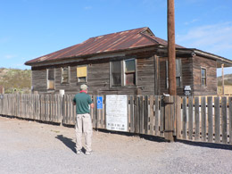
Bill Reads the Welcoming Sign |
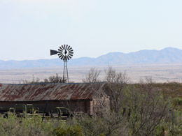
Shakespeare, NM (The Ghost Town) |
Kartchner Caverns
Kartchner Caverns State Park is a stunning, limestone "living" wet cave and one of the largest and most beautiful caverns in the country. It has been the talk of the town since it opened ten years ago in 1999.
We go directly to the Discovery Center (AKA The Visitor Center) to buy our tickets. Signs are clearly posted that no items (bags, purses, packs, bottled water, etc) are allowed into the cave, so I reluctantly leave my camera in the truck. It is strange for me to explore without my camera. The pictures for this journal are borrowed from the Internet.
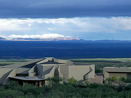
Kartchner Caverns - Discovery Center |
We buy a ticket for a tour leaving in 45 minutes. We are lucky – it once took months to book a tour. We explore the Discovery Center and learn a few facts before our tour begins.
History:
Back in the 1970’s, Randy Tufts and Gary Tenen were then students and roommates at the University of Arizona. They also had a passion for spelunking and looked for new caves to explore.
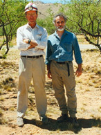
Randy Tufts
Gary Tenen
Discovered the Cave
|
In 1974 Tufts and Tenen stumbled upon a massive pristine cavern in the eastern base of the Whetstone Mountains. They kept the cave a secret and for years while they went about mapping miles of passageways. They discovered two massive rooms, each the size of an opera house and filled with natural treasures. Because they were environmentalists, they knew how easily this magnificent find could be destroyed.
Four years later, in 1978, they told the owners of the property, James and Lois Kartchner, about the amazing discovery. Luckily, the owners were educators and wanted the cave to be preserved for others to learn, choosing preservation over profit. Ten years of secret negotiations followed. The cave became public knowledge in 1988 when Arizona State Park approved the purchase. Tufts and Tenen, the Kartchners and other good guys, such as Governor Bruce Babbitt, fought and won the battle to preserve and protect this awesome natural wonder for the public.
NOTE: Randy Tufts died on April 1, 2002 of cancer. |
Our blonde, thick pony tailed enthusiastic guide lost her job as an official ranger a few years ago. She loves these caves and now volunteers her time showing tourists around. She has a few acres near the caves and has checked every inch hoping to find her own cavern – but it ain’t happening.
Our guide gives our group of about 15 minutes of the basic stalactites-stalagmites cave introduction. The cutest 10-year-old nerdy boy, who was with his Dad, joined freely in the discussion. He knew everything about geology and caves – a very serious kid and fun to observe.
We board an electric tram that takes us from the Discovery Center to the entrance of the cave, not far from the sinkhole where Randy Tufts and Gary Tenen first entered back in 1974.
We are blown away from the extraordinary precautions taken to conserve the cave's near-pristine condition. During the development, the park service built a 420-foot-long, man-made tunnel sealed by a series of airtight doors designed to preserve the cave's interior climate -- temperatures in the high 60s and relative humidity from 97.5 percent to 100 percent. If the desert air were allowed in, the cave would dry up. Unlike other caves with flashy lights and gimmicks, this cave is about preserving and presenting the natural beauty. We are very impressed.
We take the Rotunda/Throne Tour – our only option. The other cave, The Big Room Tour, opened in 2003. However it was closed for the season. They close the Big Room when around 1,000 pregnant female cave myotis bats return to roost there around the end of April. Here they give birth to a single pup in late June. The babies stay in the roost each evening while their mothers go out and find insects in the countryside. By early August the babies are flying and can join their moms in feeding outside the cave each night. Mothers and their kids leave in mid-September to migrate to their winter roosts.
We walk along a 1.2 mile "barrier free" trail viewing stalactites, stalagmites, white helectites, translucent orange "bacon" and shields of white calcite that adorn the walls. Many of the minerals found in the cave are not found in any other cave in the world.
Among the cave's most interesting features are:
- One of the world's longest soda straw stalactites: 21 feet 2 inches (Throne Room)
- The tallest and most massive column in Arizona, Kubla Khan: 58 feet tall (Throne Room)
- The world's most extensive formation of brushite moonmilk (Big Room)
- The first reported occurrence of “turnip” shields (Big Room)
- The first cave occurrence of “birdsnest” needle quartz formations
- Many other unusual formations such as shields, totems, helictites, and rimstone dams
- 45,000 year-old bat guano
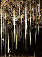
Soda Straws |
Living Formation |
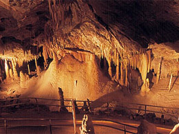
Cavern Trail |
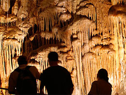
In Awe of the Formations |
Our guide also points out the tracks hugging the side of the room. This is the original trail of Randy Tufts and Gary Tenen. Randy and Gary retraced their steps each time they came to map and explore the cave, leaving a single trail, instead of massive footprints over the entire cave.
Beyond the final airlock is the Rotunda / Throne Room, a 200-foot-long, 120-foot-wide cavern with an arched ceiling about 45 feet high. To the right, a beautiful butterscotch-colored drapery flows off the sidewall, ending in a frozen puddle of calcite on the cave floor. Another fascinating features in this room is the bell canopy, formed by water flowing over a bump on the wall, then dripping to create a beautiful formation.
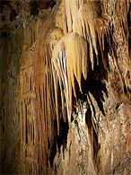
Bell Canopy |
We sit quietly on bleachers overlooking the massive Rotunda / Throne Room and listen to some impressive music (the composition now escapes me). Afterwards a few minutes of introspection, our guide asks for final questions or comments. The experience moves one “church lady” in the group. She launches into a mini sermon and shares with us the wonders of God and His great creations. She is ready for group prayer when the guide wraps up the tour.
We emerge from a protective tunnel and into the sunlight and back on the tram. It was amazing to leave that cold, damp wonderland in the ground and then feel the warm, bright Arizona sunshine above. There is indeed something very special about this place.
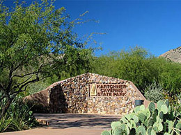
Outside the Caves |
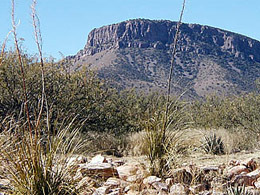
Land Above the Caverns |
We make a quick peanut butter sandwich in the parking lot and head west toward home. We arrive at 7:30, with time to run down and say “Hi” to the kids and report on another successful adventure!
|


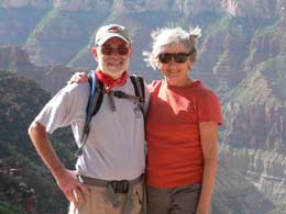
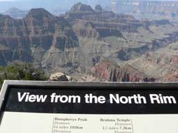
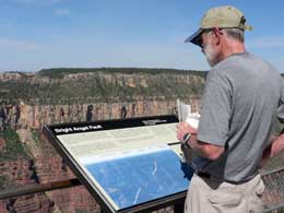
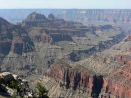
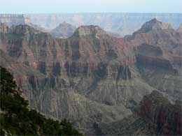
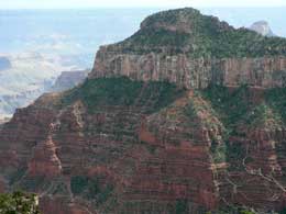
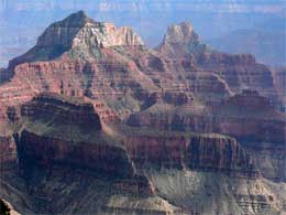
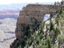
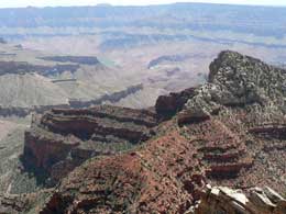
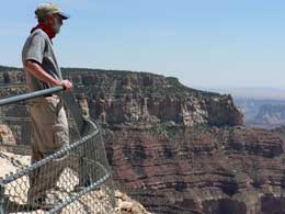
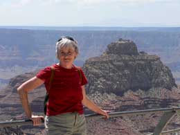
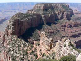
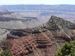
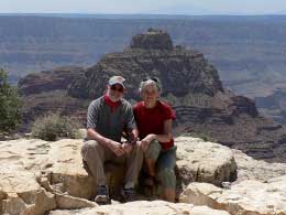
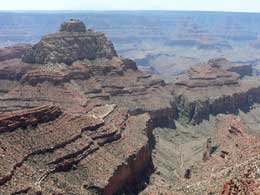
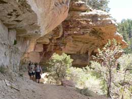
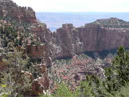
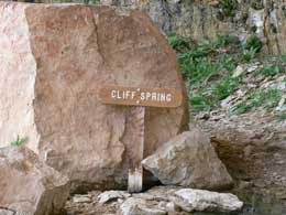
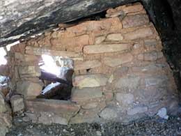
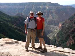
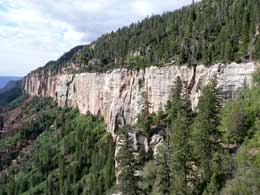
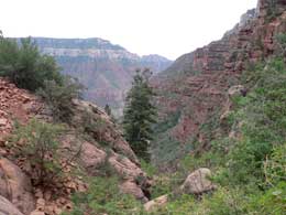
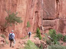
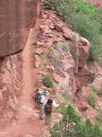
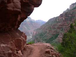
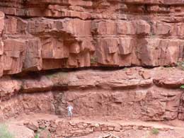
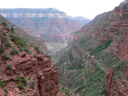
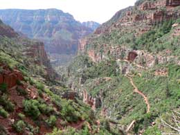
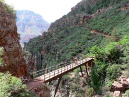
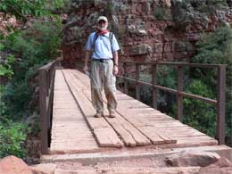
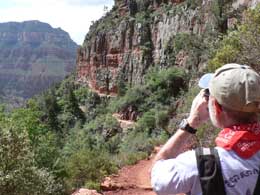
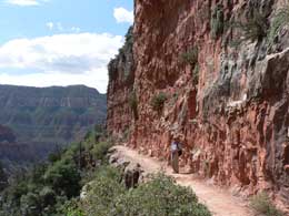
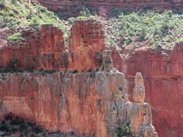
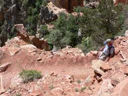
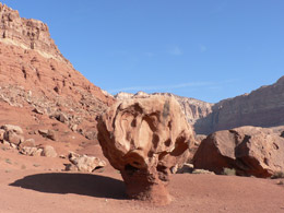
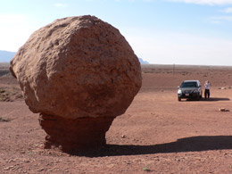
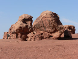
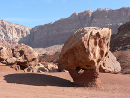
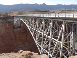
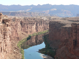
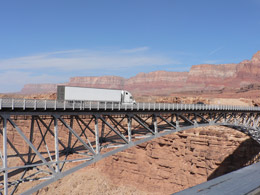
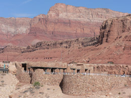
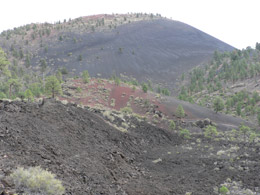
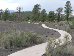
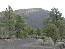
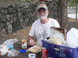
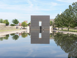
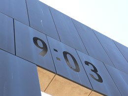
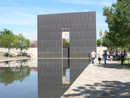
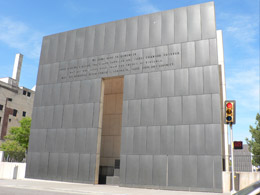
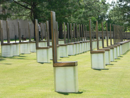

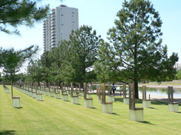
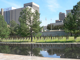
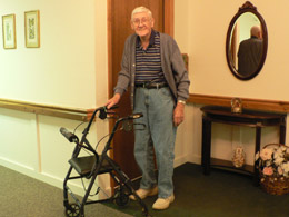
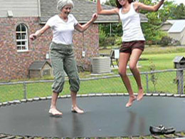
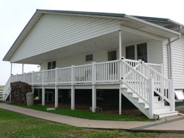
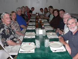
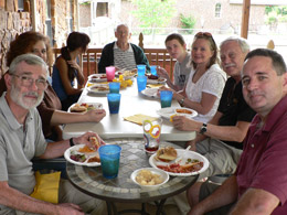
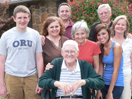
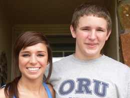
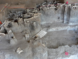
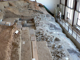
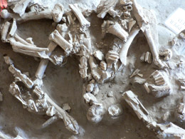
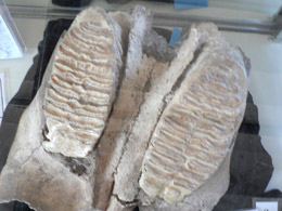
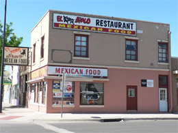
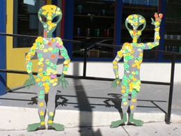
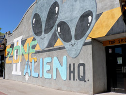
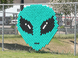
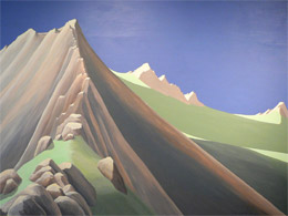
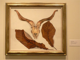
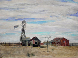
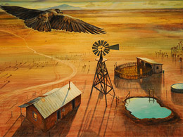
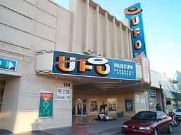
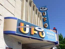
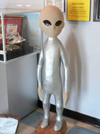
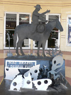
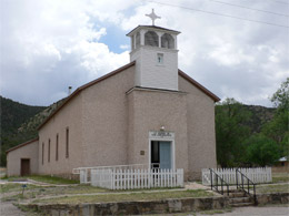
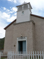
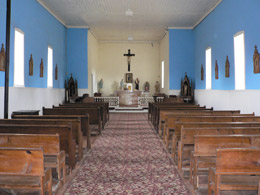
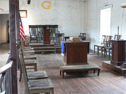
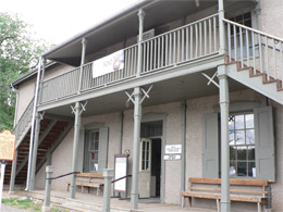
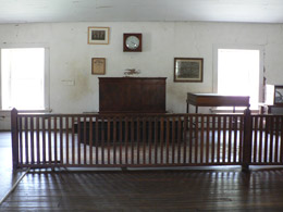
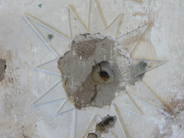
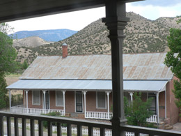
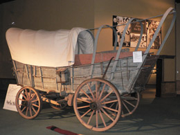
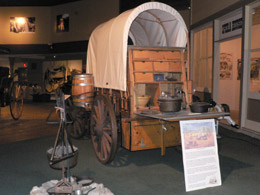
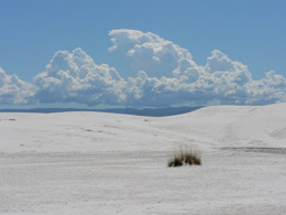
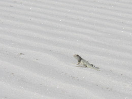
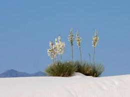
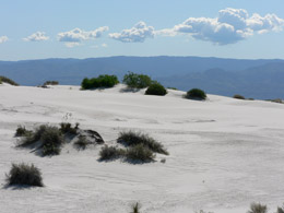
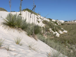
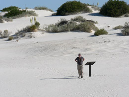
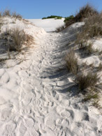
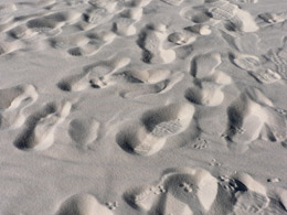
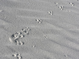
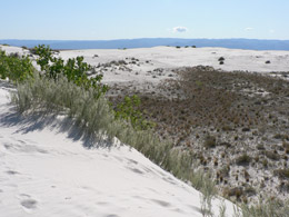
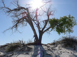
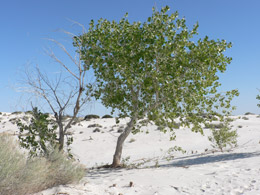
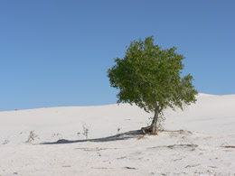
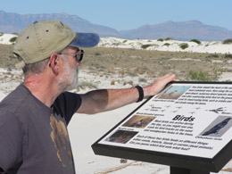
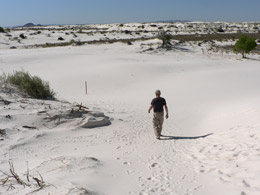
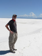
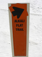
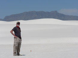
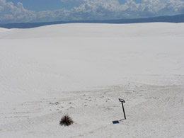
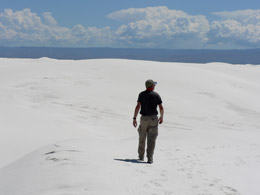
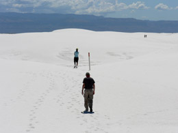
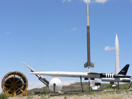
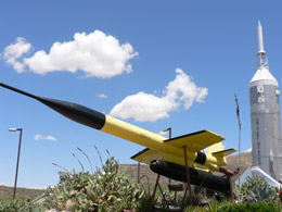
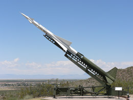
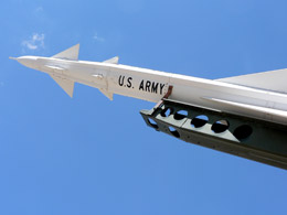
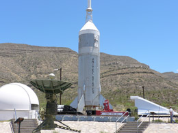
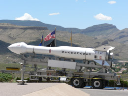
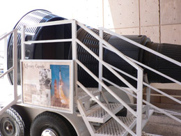
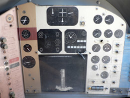
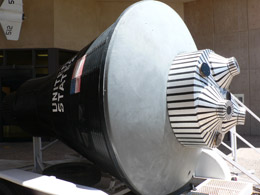
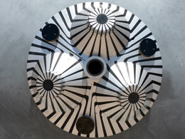
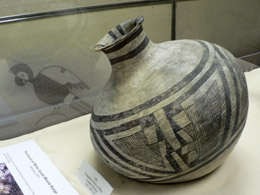
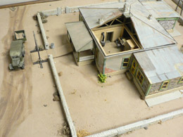
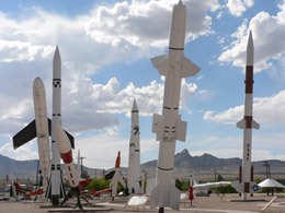
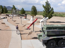
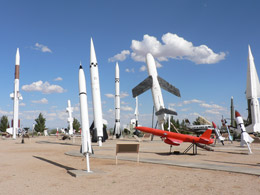
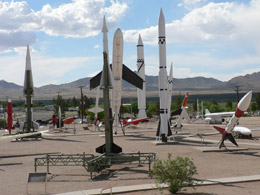
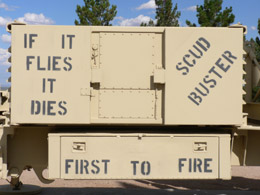
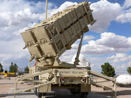
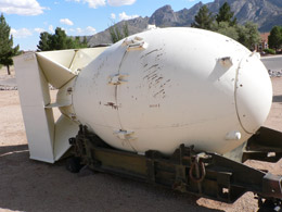
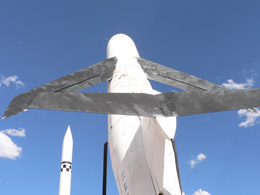
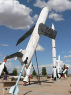 Betcha it's Loud
 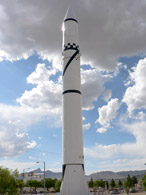 To the Moon
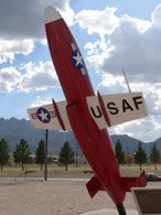
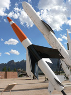
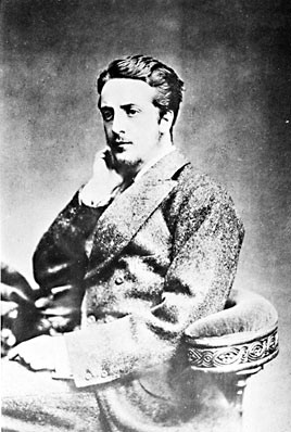