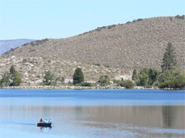
9/9/09 San Diego to Rock Creek Resort
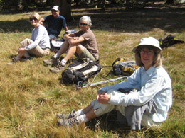
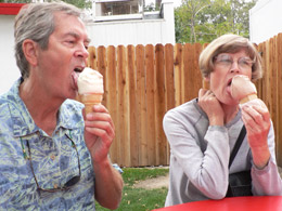
We eat breakfast, pack up the car, and get the house ready for Billie McKig’s visit. We arrive at the Mira Mesa Park and Ride exactly at 9 a.m., but get a message from Lee and Carolyne en route. They’re running late and will be there in 20 minutes. I take off on foot to find a bathroom. Ralph’s is open and within striking distance.
Lee and Carolyn arrive and we take off for our grand adventure. We drive in caravan, connected only by cell phone – what a great invention. We stop at the Astro Burger at Kramer Junction for lunch only to find it closed. We phone Lee and Carolyne for Plan B – the Roadhouse Restaurant. We all order a burger from the Senior’s Menu. There is a long wait and the burger and fries arrive a little cool – I hate it when that happens.
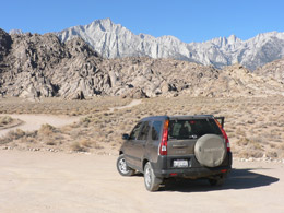
We head toward Bishop. Carolyne and Lee spot Bobby along the roadside with a flat tire on his camper. We zoom by and didn’t even notice him. Lee and Carolyn, the good guys, go back and help him. Lee helps Bobby change the shredded tire while Carolyn watches out for the big trucks zooming by. They leave a message on our cell phone voice mail because there is no coverage in this stretch of the highway.
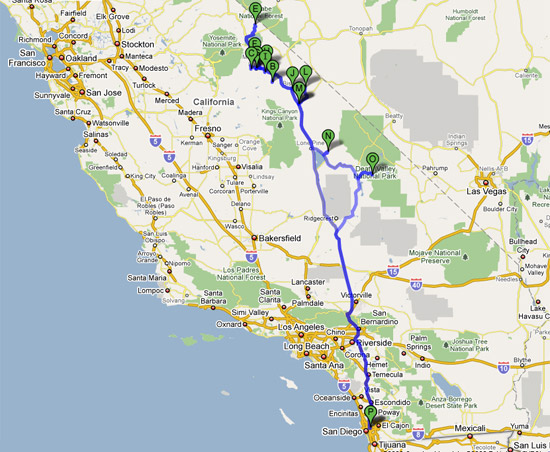
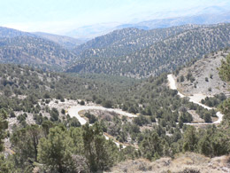
Road map of our trip |
Bill and I stop at the Interagency Visitor’s Center just south of Lone Pine and learn about the Owen’s Valley. The lake is dry. It’s shocking to see. All the water is (and has been) piped to L. A. (as depicted in the movie Chinatown). Interesting valley – too bad they gave their water away.
We drive into Lone Pine to gas up – then turn back looking for Lee and Carolyn. We find them just outside town. After a few “U” turns, we take a little side tour of Lone Pine, looking for Carolyne’s childhood home and the church where her Dad was the minister (from 1945-48). She thinks we found it.
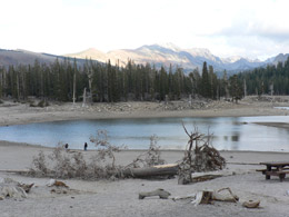
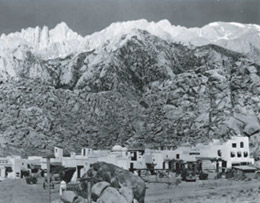
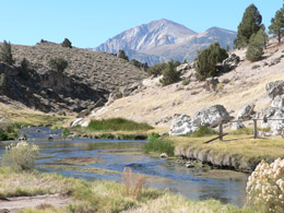
A few more “U” turns and we’re back on 395, continuing to our destination – Rock Creek Canyon. We drive through Bishop, through Independence, through Big Pine, then left at Tom’s Place and on to our little cabin at Rock Creek Resort.
We listen to Obama’s speech about health care on the radio . . . then check into our cabin. It’s a wonderful, quaint little place. We unpack, have a beer (gin and tonic for Carolyne) and then make dinner. Lee grills steaks while we make a salad, and green beans. (We have my chocolate zucchini bread for desert.) Bobby finds our cabin. He had to replace a camper tire in Ridgecrest. It was quite a day for him.
We talk until 10. Bobby goes back to his camper and we go to bed.
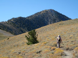
9/10/09 Rock Creek Canyon Hike -- Little Lakes Valley
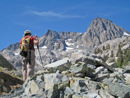
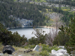
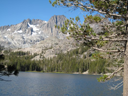
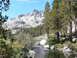
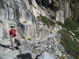
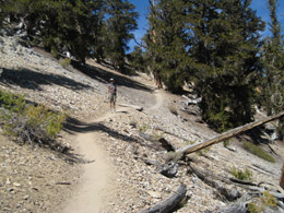
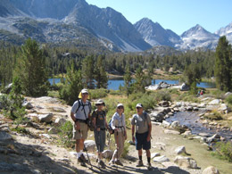
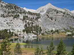
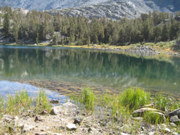
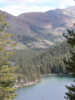
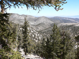
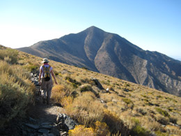
We make oatmeal pancakes (topped with peaches) and bacon – then drive a couple of minutes to the Little Lakes Valley trailhead. What a fabulous hike in the clear, pristine high alpine country. Everyone on the trail seems happy – especially the dogs. I thought one dog was an oversized Chihuahua, but the owner said it was a French bulldog.
At Little Lakes trailhead. |
 Stopping for a photo near Mack Lake |
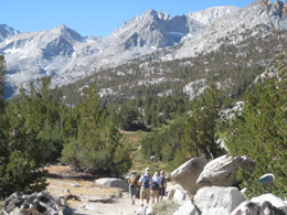
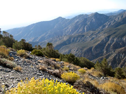
Heading south along Little Lakes Valley |
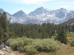
Little Lakes Valley |
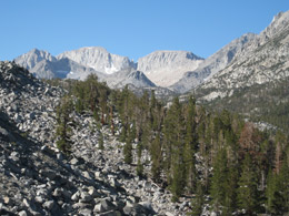
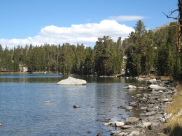
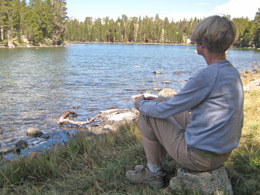
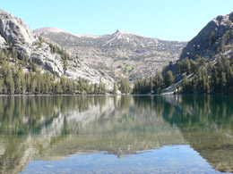
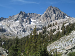
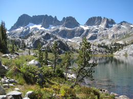
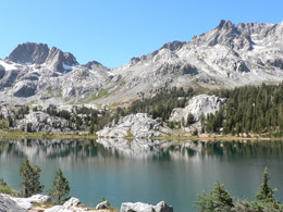
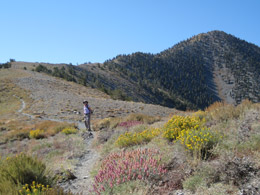
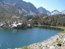
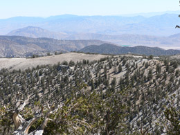
We pass several gorgeous lakes – Mack, Heart, Box, Long, Chickenfoot, Gem. The sunlight makes the trail magical -- reflecting on the water and highlighting the reeds.
Box Lake |
Heart Lake |
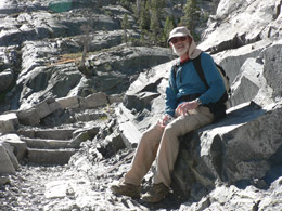
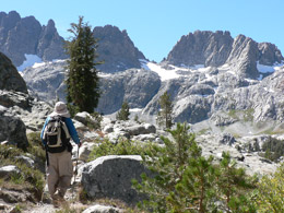
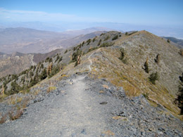
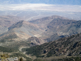
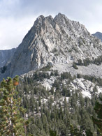
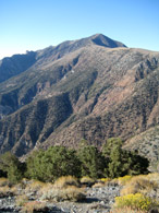
We climb over Morgan Pass (11,100 feet) – a pretty hefty hike considering this was our first day out in the high altitude. We eat lunch overlooking Upper Morgan Lake. The surrounding mountains are awesome, making you believe there is a God.
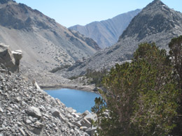
Upper Morgan Lake |
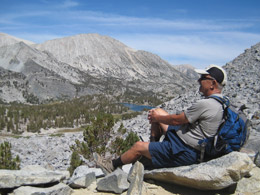
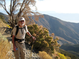
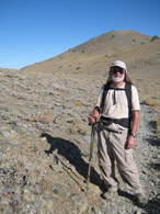
Bob taking in the view |
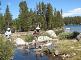
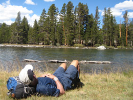
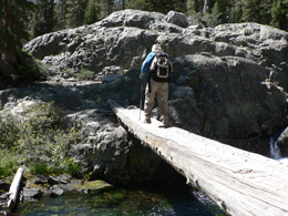
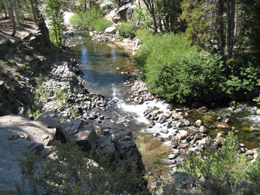
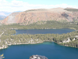
On the way back, Lee, the fisher-guy, checks the streams for fish. Sure enough, we see the trout darting about in the crystal clear streams. We hike about 9 miles – we are a happy group. (See trail map and more photos of this hike.)
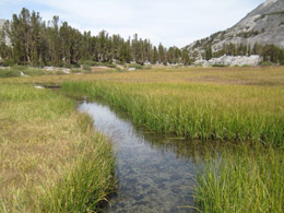
The Marsh |
Long Lake |
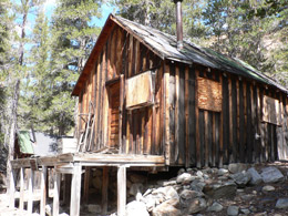
We drive back to the cabin and have a beer. Bill and I shower and then prepare the dinner – Moroccan-style-chicken cooked in a tagine. Bobby drives down the road to nab one of the last pieces of pie from the “Pie in the Sky” cafe. Lee and Carolyne explore the lake and lodge. We all rendezvous again about 6 for wine, then dinner. Fat and happy, we all sit in the rustic, cozy cabin yakking.
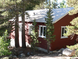
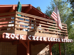
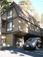
Our cabin at Rock Creek Resort |
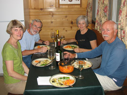
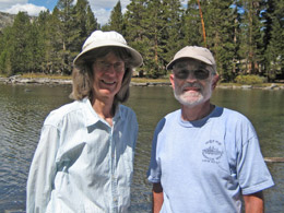
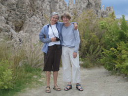
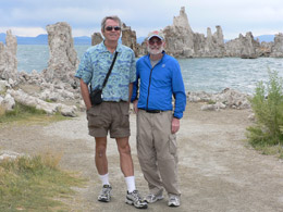
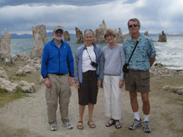
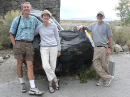
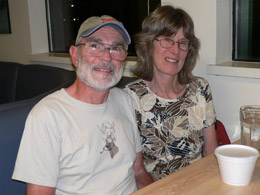
Carolyne, Bill, Nancy and Bob |
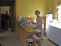
Carolyne in the kitchen |
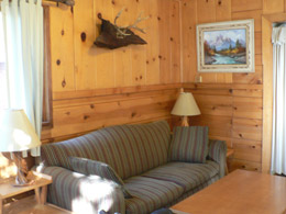
Our living room |
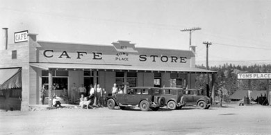
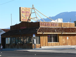
The Rock Creek Resort Store |
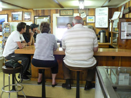
Rock Creek Lakes Resort Cafe |
After a while, Bobby returns to the campground. Bill and I drive to Tom’s Place to call Cousin Nancy to make arrangements for tomorrow. We also call home and talk to Zion and Brian. Our drive back to the cabin is quiet and peaceful under a sky loaded with stars and images of ghostly pines trees reflecting off the headlights.
9/11/09 – Hike – Rock Creek Lake to Dorothy Lake (6 mile loop trail)
We eat scrambled eggs and bacon and melon – a delightful breakfast.
Bobby and Nancy Marsh (Bill’s cousin who lives in Bishop) show up for today’s hike. (Lee takes off for a day of fishing while the rest of us go down the road a ways to Rock Creek Lake to start our hike.)
We’re on the trail by 9:30. The first part of the hike is a steady climb up. Nancy has a slower pace so I hang back with her to chat and get to know her. We stop at Dorothy Lake for an hour and have our lunch. Nobody is on the trail. The views are nice. The pine trees are strong and stately. The aspen, just starting to turn yellow, takes my breath away. I love the way the aspen leaves shimmer in the breeze (guess that's why they call them quacking aspen). We hike across drying meadows (it is the last of summer) and over rocks and streams. We have some trouble finding the trail because there are lots of trails that weave their way through this area. Before long we are back at the car in the parking lot. (See trail map and more photos of this hike.)
We take our packs off and scatter to public bathrooms. Unfortunately Carolyn goes to a different bathroom. Cousin Nancy and I sit enjoying Rock Creek Lake while Bill and Bob drive around the parking lot to track Carolyne down.
We return to our cabin for a cold brew and conversation on the porch. Nancy and Bob leave and we shower to get ready for a night on the town at Tom’s Place.
We drive 10 miles down the road to Tom’s Place. Bobby discovers he forgot his wallet. The atmosphere at Tom’s Place is raucous to say the least – and the dinner is enough to cause instant coronary arrest. One plate could feed a whole 3rd world country. Being cautious, we avoid the red meat and order turkey (against the advice of the waitress). The turkey (deli cut) and mashed potatoes (from a box) are smothered in thick, gooey gravy. There are 5 drunken middle-aged women at a table nearby who are drinking and laughing and choking down burgers and fries with lots of beer. We are annoyed to say the least, but I think about how much more fun they are having, as evidenced by their wild gales of laughter, punctuated by load screams. We are glad to get out of there and back into the quiet evening.
Tom's Place in Quieter Times |
Back at the cabin, Carolyne whips up a little dessert for us with leftover cake, ice cream and Heresy’s syrup. We chat a little. Bobby leaves and we go to bed.
9/12/09 –Rock Creek Resort to Mammoth Lakes
We eat a quick breakfast of cereal, toast and fruit and then go about packing and cleaning up the cabin. The four of us make a good team. The place is spic and span and we are on the road by 9:30.
We stop at the Pie in the Sky / Rock Creek Resort Lodge to settle up and then caravan to our next destination. On the way, we pass herds of cyclists grinding their way up a never-ending hill. Who are they? And Why?
We take a left onto 395 (at Tom’s Place), pass by Lake Crowley and drive on into Mammoth Lakes, where we stop at the Visitor’s Center. We gather coupons and maps and quiz the ranger about the road to Bodie. She said it was mostly unpaved from 395, but fairly good. We leave our car at the Visitor Center and ride with Lee and Carolyn for our day of sight seeing. (We have to reorganize the cars a bit to fit us all in.)
Our first stop is Lee Vining. It’s about 10:30 and too early to eat, so we buy turkey wraps at the General Store to take to Bodie. Carolyne and I have to pee, so we dash into the Lee Vining Visitor’s Center (very nice) and have to wait in line for a one-holer. The place is packed with Germans. They’re everywhere enjoying our wonderful scenery. It makes me proud to share our country’s grandeur, but also makes us wait in line a little longer.
Meanwhile, Bill and Lee, waiting in the car for us girls, aren’t too thrilled with the situation. I feel guilty; Carolyne just brushes them off.
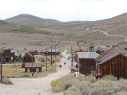
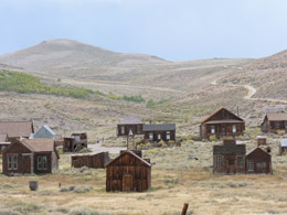
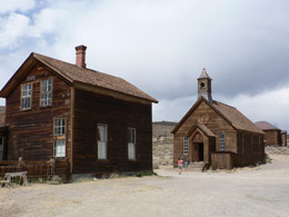
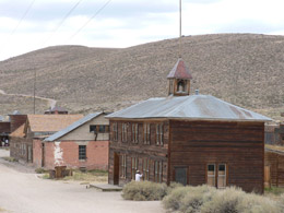
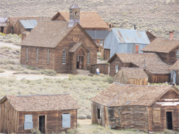
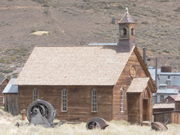
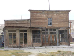
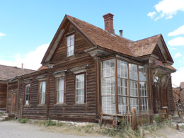
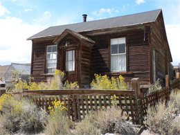
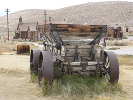
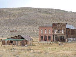
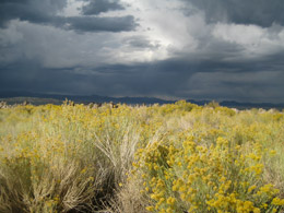
The clouds start rolling in as we make our way up to Bodie, the old mining town. We drive on unpaved, washboard roads for only the last few miles. We pass a shepherd tending his sheep. It would have been a quaint scene if he weren’t wearing a bright baseball cap. Maybe he's a descendent of Basque who settled here years ago. We arrive in Bodie, find a picnic table and enjoy our turkey wraps wondering if the storm will blow in.
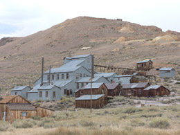
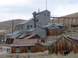
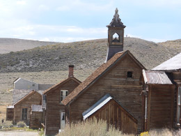
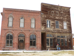
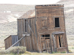
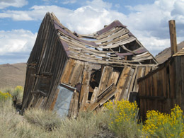
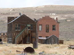
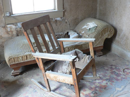
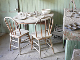
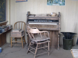
About noon, with sunshine winning out for the time being, we enter the charming old town frozen in time. Bodie is a State Historic Park and was known as the wildest town in the west with booming gold and silver mining businesses. The population was over 10,000 from 1877 to 1888. There are only about 5% of the buildings left standing. We wander down the dusty streets while Carolyne reads the self-guide booklet to us. She is serious in her role as our appointed guide. From time to time, she has to corral us as we wander off to snap photos and peak into the old houses and stores. I’m glad she is dispensing information. It is a most fascinating place. Everything was in disrepair and covered in dust as if the residents all awoke one day and left the town. We see:
- The old church (where the 10 commandants are stolen from the wall)
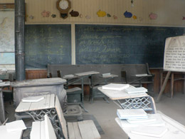
- The school that some juvenile delinquents once burned down
- Homes of mine superintendents, sheriffs, lumber lords,
- Home of a former madam who married well and became an artist
- And other assorted places such as saloons, the old union hall, pool hall, boarding houses, saw mill, gas station, saddle shop, and morgue.
We visit the museum (set up in the old union hall) with simple display cases. One is filled with opium paraphernalia; another with fashionable ladies’ hats and a little vile, once used to catch tears from grieving. After a year of crying over one’s dearly beloved and saving the tears in the vile, the loved ones pour them on the graves of the deceased.
After we explore the town, we walk up the hill to check out the graveyards – there are three in all on the hill overlooking the town. We view a few graves before raindrops start to fall and then we dash back to the car.
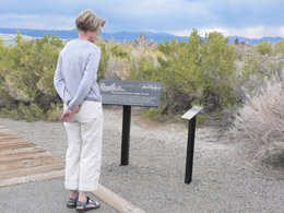
Carolyn takes the wheel and we are treated to the most wonderful thunder and lighting storm. Luckily the storm blows away by the time we stop at the Mono Lake Visitor’s Center. It’s a gorgeous building with a large Obsidian rock at the entrance.
Lee, Carolyne and Bill in front of obsidian rock |
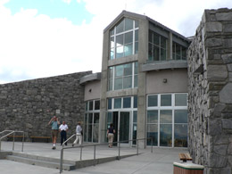
The beautiful Mono Lake Visitors' Center |
Outside the Visitor’s center we see two volcanic islands hovering in the large lake – Paohoa and Negit. Paohoa, the larger of the two islands, does not look volcanic because its surface is actually the lake bottom sediments. About 300 years ago, magma rose underneath the lake and pushed these sediments above the water level. Negit, the black island, was formed by volcanic eruptions that occurred between 300 and 1,700 years ago. Negit once was home to most of the state’s nesting California gulls. When the land bridge emerged in 1977, most gulls moved to nearby islets to escape predators that could reach their nests.
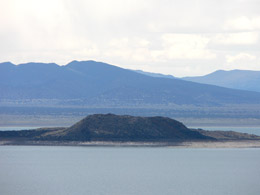
Negit Island, Mono Lake |
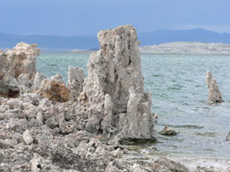
Some small tufa |
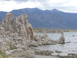
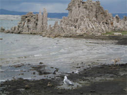
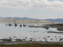
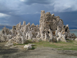
Mono Lake is also known for tufa – the knobby white towers scattered about the shoreline. Tufas are deposits of calcium carbonate. These limy structures cluster where fresh-water springs rise from the lake bottom and are exposed when the water level drops. The fresh water looks like vegetable oil swirling up in the salty lake water. When the lake is calm for a few days, you can see delicate new tufa crystals forming around the springs. Basically, Tufa is petrified spring water. Algae also add to the creation of the tufa, much like coral – a limy deposit secreted by tiny animals in the ocean. The tufa on Mono Lake closest to the Visitor’s Center is not very impressive. Later, we drive south of the lake to explore some handsome tufa.
The area around Mono Lake looks barren with very little vegetation, but because of the abundance of two little critters--brine shrimp and the alkali fly--the place supports many birds. The alkali fly larvae also was the main food source for the Mono Indian Tribe (the word "mono" is Yokut for fly people). The Mono Indians called themselves "cusavi" or fly-eaters. They scooped the larvae up from the waters and dried them as a nutritious food source used in soups. The “fly people” also make trips to Yosemite to trade their dried larva with the Miwok tribes.
We skip the 20-minute video and drive on into to Lee Vining and to have a frosty ice cream cone – We do have our priorities.
Lee and Carolyne at Frosty Freeze |
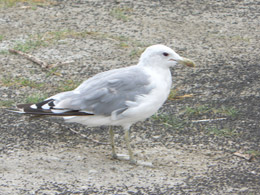
We drive to the southern part of Mono Lake to wander around the tufa structures and take the path down to the edge of the shore. I am struck by the changing color of the ground at the water’s edge – from black to white. When the alkali flies are clustered and settled, the ground is black, but that quickly changes to sandy white when the flies flock in new directions to avoid the beaks of the sea gulls. We see a few sea gulls with easy pickings. It is an amazing sight– only wish I had studied the “larvae” display a little more at the museum.
The sun (and the battery in my camera) are both fading – just when the lighting is getting very interesting and the surroundings oh so dramatic – Darn!
Tufa |
It was a dark and stormy afternoon |
After leaving Mono Lake we arrive at Obsidian Dome. We drive right up to a 300 ft. Obsidian (volcanic glass) dome. The sun reflects on the large shiny black boulders. We crawl around the big boulders and pick up some lose little chips on the ground. We look for ones with the sharpest edges. What was it like for the Native Americans? What criterion did they use to pick out just the right rocks for tools and weapons (and in some early cultures, even brain surgery)?
Obsidian Dome |
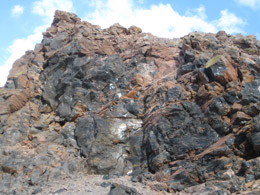
Obsidian Dome |
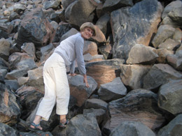
Carolyne looking for the perfect piece |
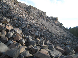
Obsidian Dome |
After all the day’s adventure, we still have time for one more stop – a mile or so hike to the edge of Inyo crater. We wonder what kind of meteor could have left such a giant calling card, but read later the crater’s origin is volcanic. Carolyne’s acrophobia kept her well away from the edge of the two giant holes.
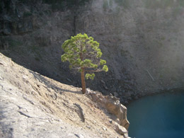
Inyo Crater |
Inyo Crater |
We return to the Mammoth Lake Visitor’s Center to pick up our car and drive to our condo. The condo is perfect for us. We have wine and snacks and then head down to Perry’s for pizza and beer. We come home and try to figure out how to use the tv’s – any one of them would do. Lee and Carolyne crack the code and master the process just about bedtime.
9/13/09 – Mammoth Lakes
We sleep in until 8:30 – very late for us and then eat breakfast at the condo.
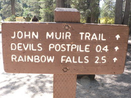
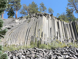
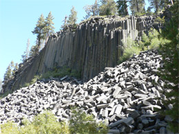
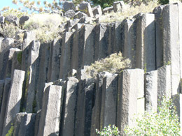
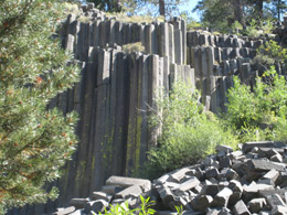
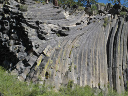
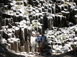
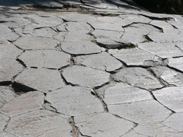
We take the Bamberger car today and drive down a scary road to Devil’s Postpile National Monument. The trail begins next to the parking lot. We climb steadily up the trail and marvel at the huge post-like columns. Devils Postpile was created by fire and ice. A volcanic eruption and cooling of basalt lava created an impressive wall of columns. Later a retreating glacier exposed the columns and polished smooth the top of this formation to look like tile flooring where all the posts fit together. This is some geological area!
From Devil’s Postpile, we take the trail to Rainbow Falls. On the way, we see the results of the 1992 Rainbow fire. Not far from the burned out area, it’s green again and we see a deer.
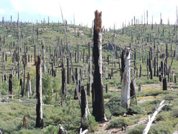
Devastation from the 1992 Rainbow Fire |
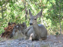
Deer along the trail |
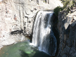
Rainbow Falls is a welcome respite. The roaring falls are huge and attract a lot of weary hikers. The falls flow into a gentle stream. It is a lovely spot and reminds me of Hawaii.
Rainbow Falls |
Trail to Rainbow Falls |
We head back on the trail for a bit, but then catch the trail to Red's Meadow, which leads us by the Red's Meadow lodge for a burger and shake. The place is loaded with history hanging on the walls. I check out the framed black and white photos from the days of mining, logging, and people out just having fun. I spot the fading photos of stars like Art Linkletter and John Wayne. There is a large painting of the 20-mule team borax, made famous in these here parts. I read the typed letter from Ronald Reagan (then governor of California) thanking the owner for a having a horseback-riding getaway for the high level bureaucrats. When we finished lunch, I notice that Reagan’s letter is missing from the wall, then someone replaced it by the time I told the waitress. Weird timing. Turns out a guest just wanted a copy of the letter. (And my mother told me not to be a busy-body!)
We stop at the Red's Meadow General Store and I buy a bear for Zion. It spoke to me – in fact, the whole place spoke to me. I like the rustic, simple little cabins and the Mama Bear and Papa Bear bathrooms. To think this place probably started out as a little mining town.
We hike back to our car. On the way, we see a little black beer crossing the road and then head for the hills. He looked lost and scared. (See trail map and more photos of this hike.)
We make a stop in Mammoth Lakes to buy some beer and snacks while Carolyn finds a lovely leather shop and buys some classy slippers.
We go back to the condo to drink our beer and eat some snacks. We have just enough time to take a drive through the Old Mammoth Lakes area where Lee and Carolyne took their kids camping many moons ago.
We see Tamarack Lodge, a quaint elegant place built in 1924 (with items like confit of duck on the menu). It’s situated right across from the Twin Lakes. We see lots of lakes (Lake George, Lake Mary, Horseshoe Lake) and lots of lonesome fishermen scattered about in the fading light. At Horse Shoe Lake, all the dying trees shock us. The CO2 from the lake is the culprit that’s killing them.
We eat a magic salad that Carolyne tosses together and leftover pizza from Perry’s and then watch 60 Minutes. All three segments were good -- Obama discusses the national Health Care Plan, Ted Kennedy discusses his life (post mortem) and the soap opera, “The Guiding Light,” is finally coming to an end after 50 or more years. We stuff ourselves with popcorn and chocolate while we watch another program on grizzly bears and then the PBS Mystery show.
9/14/09 – Mammoth Lakes
We eat bacon and French toast and then say goodbye to Lee and Carolyne who are going home today.
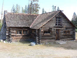
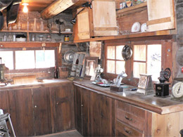
Bill and I visit the Mammoth Museum and Hayden Cabin, housed in an old log cabin once owned by Emmett and Margaret Hayden. The cozy little cabin, located on the grassy banks of Mammoth Creek, is over 80 years old. It’s an authentic log cabin handcrafted by Emmett from 1927 to 1938, one of the first summer home permits issued by the Forest Service. Now the cabin is a historical museum (with free admission) and has just the right amount of stuff to get a great insight to the early decades of life around here.
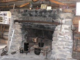
Emmett was a mapmaker from southern California who also made maps of the Eastern Sierras, and, just for fun, re-named some of the places after his friends. Lake Margaret, changed to honor his wife, actually stuck. He was a happy drunk who liked to play poker and have a good time. (Emmett even lost the title to some mining company in a fierce poker game.) Wife Margaret was an introvert and good cook and entertained his friends cooking on a big old iron stove. I liked the place and the photos. One of my favorite photos was the entire town gathered in a lodge – they had just decided to buy electricity and bring it to their homes ($100) and businesses ($600). Emmett and Margaret died child-less, and willed their cabin to their pals.
Hayden Cabin |
Inside Hayden Cabin |
Inside Hayden Cabin |
Margaret could make this stove sing |
The next museum (the Ski Museum) was closed, but the door was unlocked so we snuck a peak.
Next stop, Earthquake Fault -- it’s a very deep crack, but probably not a “fault,” just another crack in the glassy volcanic rock. I will remember it as the place the folks in the 1920’s stored their ice – and even made ice cream on hot summer days.
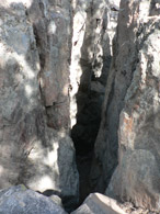 Earthquake Fault
|
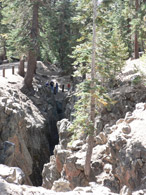 Earthquake Fault
|
About lunchtime, we drive back to town and stop at One World Eats. It is really bad – and what made it worse is that Bill wanted to eat at Pita Place. We choked down a Greek salad, borscht and a chicken thing in pita bread with strange tasting spices. For the rest of the day, I keep munching on snacks, hoping to erase the dreadful flavors.
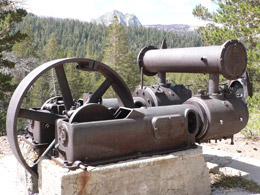
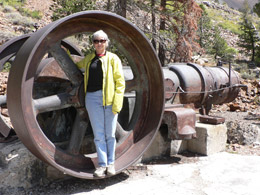
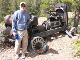
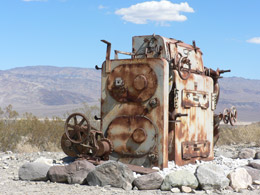
We explore the Mammoth Consolidated Mine -- a hot mining spot in the 1870-80’s, but bought in a sheriff’s sale in 1927 by Archie Mayhen, his father and other investors. It shut down in 1933 with the Great Depression. Archie went on to develop the tourism industry in Mammoth – good move. We amble through the area, checking out the old bunkhouse cabins, Archie’s main house and several old rusting pieces of heavy mining equipment left behind. The views are awesome.
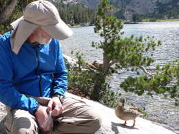
Next, we hike up to Crystal Lake – almost 2 miles straight uphill – the views are spectacular. We stop to rest and eat some snacks by the high alpine lake. A well-trained, very bold duck immediately swims up to us, climbs out of the lake and makes her way to us. Against our better judgment, we hand over some almonds and pretzels. The duck is way too friendly, so we hoist up our packs and head back down the trail. Coming back fast and easy – mostly downhill. We stop on the trail to visit with a gal who carried her parrot pal, Archie, on her back. (See trail map and more photos of this hike.)
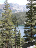
Looking back at Lake George |
Lake George |
Trail to Crystal Lake |
 Crystal Crag
|
 Lakes George and Mary
|
Bill makes a new friend |
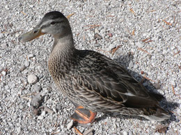
If it looks like a duck. . . |
Woman hiking with parrot cage |
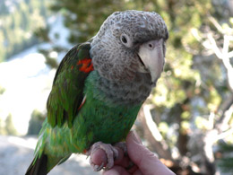
Archie the parrot |
We try to explore the Old Mammoth Site – but nothing was there. Then we start to climb up to Panorama Dome, but it’s getting late. We’re tired and hungry and have done enough hiking for today, so we drive back to town.
We get supplies at Von’s and go home for a beer. I prepare a spaghetti dinner while Bill loads up washer and fixes the computer. It is a quiet evening. I catch up on my journal and watch Jay Leno’s new show.
9/15/09 – Mammoth Lakes (All Day Hike to Ediza Lake)
We drive out on the windy road to Agnew Meadows and see a couple of deer crossing the road. At 8:30 a.m., we are at the Ediza Lake trailhead. We start early because the guidebook says it’s a 13 mile hike, with 1,700 feet of elevation gain. (Actually it turned out to be a 14.4 mile hike, as tracked by Bill’s GPS. We made a wrong turn and added some miles.)
The hike is exceptional. I use my headphones to keep up a hardy pace. We travel through meadows and forests. We cross streams and follow along rushing creeks. We climb steep rocky outcroppings and stop at picture perfect lakes – Olaine Lake, Shadow Lake, and Ediza. Our turnaround point (Ediza Lake) is one of the most beautiful places I've seen. “Amazing Grace” is playing in my headphone just as we round the corner to beautiful Ediza Lake. What a moment! I know I tend to gush – but this place is worth seeing. The calm lake is surrounded by rugged lava cliffs capped in snow (even in September) and minarets. We gaze at Mt. Banner and Mt. Ritter and eat our peanut butter sandwiches. We pack up and head back at 1:00 (returning to the car at 3:30). We pass a lot of people – folks out with their dogs, fishermen (no fisherwomen) and a lot of overweight, out of shape, middle-aged backpackers trying to prove something. I know because I’m an aging woman – in shape, but still trying to prove something. My heart held up fine – thanks to the doctors who have propped up my arteries with a couple of stents. (See trail map and more photos of this hike.)
Back at the condo, we down a beer immediately and then shower. We watch the evening news and then go to a hole-in-the-wall Mexican dive – Jalapeno’s. We stuff ourselves with the $7.50 special (while I pretend I’m not a heart victim).
We come back to the condo and curse the Internet connections. Bill tries everything to get the router to behave – same old story. I catch up in my journal and regret eating all those enchiladas and tacos. (This too shall pass.)
9/16/09 – Mammoth Lakes to Bishop
We get up early to tidy up the condo, pack up and head east out of town to Bishop. It’s a gorgeous day with blue skies and adventure ahead.
Leaving the condo |
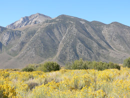
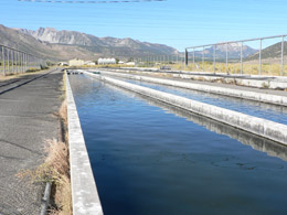
Our first stop of the day is Hot Creek Fish Hatchery (right off 395 on Hot Creek Hatchery Road) a state run operation with the goal of stocking the rivers and lakes with various species of trout. Located in a desolate area, we walk along long, narrow concrete pools loaded with fish excited to see us and hoping for a handout. We buy 25 cent worth of fish pellets from a vending machine and make a lot of fish friends. They certainly know we’re coming. Some of the concrete pools are covered with thin wire anchored high above the pools to keep the birds out. We stroll around the place, just the fish and us and strange equipment without a soul in site. (That’s the state of California, I guess).
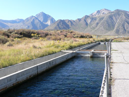 Hot Creek Fish Hatchery
|
 Hot Creek Area
|
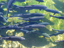
Trout at the hatchery |
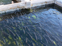
More trout |
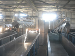
Inside building where fish are hatched |
Fish ponds |
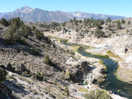
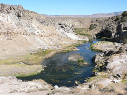
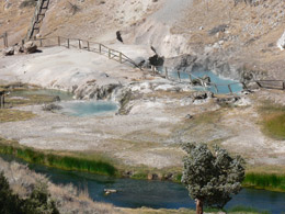
A few miles up the road is the Hot Springs Geologic Site – a real surprise for us. We are in a 700,000-year-old volcano that is still acting up. The geological activity far beneath the earth’s crust brings steam and hot water to the surface, mixing with the creek’s cool waters. If you’re ever in the neighborhood, don’t miss this fascinating place. Our timing is good -- we arrive right after a huge tour bus is collecting the last of its travelers from the public bathroom. We stroll down the path to the bubbling pools and steaming fumaroles. We read the signs of warning and then climb over the fence anyway to get a better picture and check the temperature of the water.
Hot Creek |
Hot Creek |
Hot Creek |
Hot Creek thermal pools |
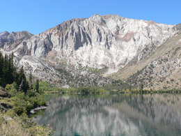
We return back to 395, go down the road a few miles and drive to Convict Lake, an idyllic lake surrounded by mountains (Mt. Laurel and Mt. Morrison), forests and lots of fishermen out for a good time. We have a light lunch and then hike about 3 miles around the perimeter of the lake. We see lots of happy hikers and a few happy dogs. The lake is called Convict Lake because in 1871, a band of desperadoes escaped from the state prison at Caron City, Nevada. They headed south, followed by a posse, and are trapped in the canyon at the end of the lake. During an intense gun battle, the posse leader, Robert Morrison, was killed. The majestic mountain at the end of Convict Lake, Mt. Morrison, was named in honor of the slain posses leader.
Mt. Laural with Convict Lake in foreground
|
Convict Lake
|
We finish our loop around the lake, get in our car and drive back to 395 and then on to Bishop. We gas up at the Paiute Palace Reservation, advertised as the cheapest gas in town ($2.95 a gallon) and then head to Jack’s for a burger and fries (the best fries in the West). With our tanks and bellies full, we’re ready to do Bishop. We stop at the Bishop Visitor Center in hopes of finding a good motel recommendation. No luck, the gal refers us to the Bishop Lodging Booklet -- no hints allowed.
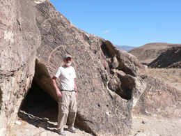
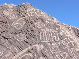
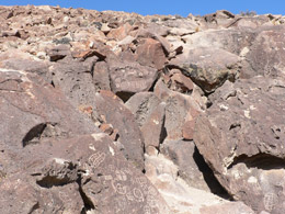
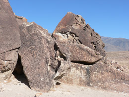
We take our coupon ($49) and go to America’s Best where we stayed a couple of years ago. It fits our criteria – budget, quiet, clean and off the main street. We have no time to relax because we want to see the petroglyphs outside of Bishop, called The Fish Slough Petroglyphs. The petroglyphs are not advertised because so many people have destroyed them -- What a shame! We stop at the White Mountain Ranger Station in hopes of finding some direction. We wait in a long line, but we’re in luck. The Ranger hands us a brochure and a map and we’re on our way.
We drive north out of Bishop on Hwy 6, take the 5 Bridges Road to connect to Fish Sough Road that takes us to the Fish Slough Petroglyphs. The roads are unpaved and unmarked. We didn’t calibrate the mileage properly and end up driving miles out of the way. I get Bill, the map expert; to pull over to help me assess the mess I’ve gotten into. We drive back and try another road and another long drive with no petroglyphs in sight. Just as we are about to forget the whole thing, we see the first batch of rocks with ancient drawings – easy to spot because of the stone fence. The etchings are very primitive – no animals or people, only drooling. I snap photos. Bill seems bored. We get in the car and drive to the next batch only to go through the same process – I snap photos. Bill is ready to go. (After all that driving, it is somewhat of a letdown.)
 Petroglyphs
|
 Petroglyphs
|
Petroglyphs |
Petroglyphs |
Petroglyphs area near Bishop |
Petroglyphs area near Bishop |
Luckily we find a road that takes us to Hwy. 6. We go up over a desert hill and look down into the green, lush valley along the Owens River, with massive water systems spraying fields and fields of green alfalfa and draining the water table for the whole area. It’s a fascinating scene.
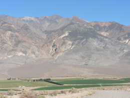
Farms along Owens River |
It’s about 5. We go to the public library to hook up with Bill’s cousin, Nancy, the librarian. We check our emails while she finishes up her work. We go to her place for a beer and lots of talk about Bill and her Danish ancestors. (Their mothers were sisters.) We stir up a lot of ghosts, I’m sure. We eat dinner at a place in the tiny Bishop Airport called Thai Thai – very tasty. We spend some time looking up into the sky and hoping a little airplane will land and light up the runway. It doesn’t happen so we say our good-byes and go back to the motel.
Bill and Cousin Nancy |
9/17/09 – Bishop to Lone Pine
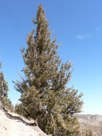
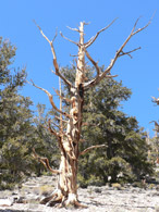
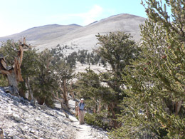
We eat cereal in our room, pack up and head to the Ancient Bristlecone Pine Forest (in the Inyo National Forest). We are considering staying at the Bristlecone Pine Forest (camping at the Grandview campground) so we can climb White Mountain Peak the following day. It’s a primitive campground – no water or food, so we stop at Von’s in Bishop to grab some camping grub before we head out to the forest.
NOTE: As it turned out, we decided not to climb White Mountain Peak. It would have been a rigorous 14-mile climb and would have resulted in 3 14-mile hikes in 6 days, a little too much for our old bodies.
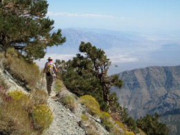
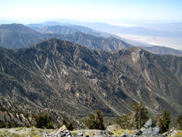
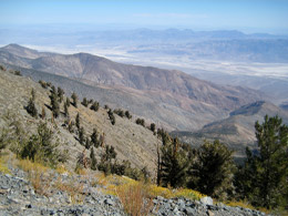
We head south on 395 to the Bristlecone Pine Forest turn off at Big Pine. There we are treated to million dollar views across Owens Valley to the Eastern Sierras. Our first stop is the Sierra View Overlook. We see over 100 miles of Sierra peaks from Mt. Whitney to Yosemite. I snap lots of photos, even though the sun is not in the best place.
View from Sierra View Overlook |
View from Sierra View Overlook |
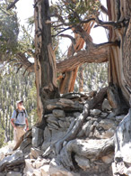
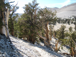
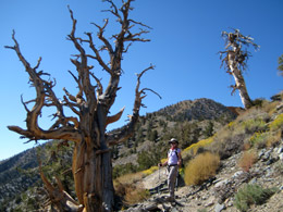
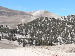
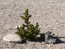
The Bristlecone Pine Forest is divided into two areas – Schulman Grove (about 6,000’ elevation) and Patriarch Grove (about 11,000’). We stop at Schulman Grove, named for Edmund Schulman, who was an expert in tree-ring dating research.
Schulman Grove’s Visitor Center was destroyed in a fire set by a mentally ill guy a year ago, so the rangers have a makeshift center in a trailer. The young gal knew a lot about the place.
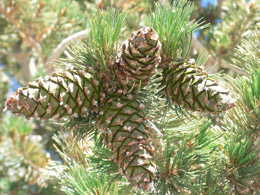
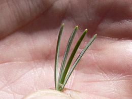
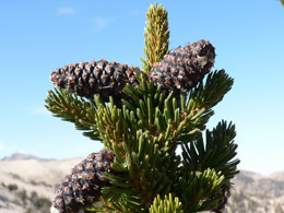
We eat a quick peanut butter sandwich and take the 4.5 mile self guided tour out of the Visitor’s Center called “The Methuselah Walk.” One of the Bristlecone Pine trees on the trail is named Methuselah and is the oldest living tree alive – 4,789 years old, as measured by a core sample taken in 1957 (according to Wikipedia). There are NO trail markers pointing out old Methuselah. The reason being too many nut cases might want to destroy it. It’s a sad state of affairs.
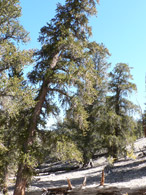
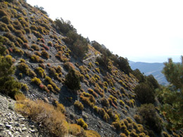
The trail passes through several ecological zones, revealing sharp contrasts caused by moisture, sun, and soil. We walk through forests and then barren moonlike landscape and then scrubby trees and brush. Bill reads the interpretive narrative while I go crazy with my camera. I try to process some of the facts, but I am too focused on getting just right photos of these mysterious trees. (See trail map and more photos of this hike.)
Schulman Grove:
Ancient Bristlecone Pine Forest |
Ancient Bristlecone Pine Forest |
Ancient Bristlecone Pine Forest |
Ancient Bristlecone Pine Forest |
The Methuselah Walk |
The Methuselah Walk |
Patriarch Grove:
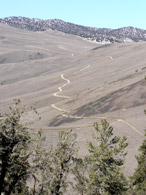
Road to Patriarch Grove |
Road to Patriarch Grove |
Patriarch Grove |
Patriarch Grove |
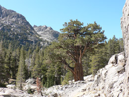
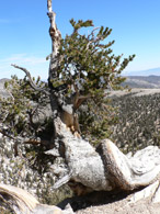
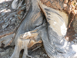
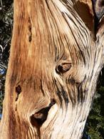
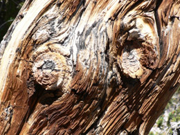
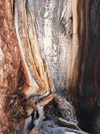
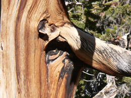
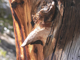
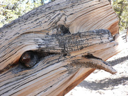
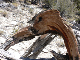
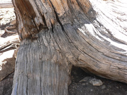
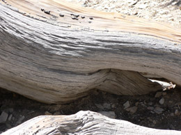
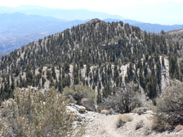
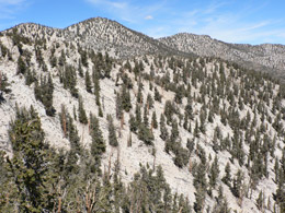
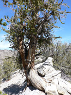
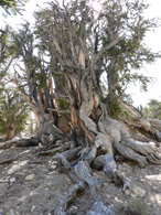
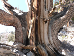
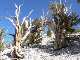
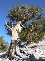
Bristlecone Pines’ secret to longevity is their ability to adapt to one tough, unique environment. They are true survivors. They only have a short growing season for any given year, adding only one inch in diameter every 100 years. They anchor their root system into dry, rocky slopes and are exposed to high winds and freezing temperatures. They have some things going for them. They need their own personal space. Therefore, forest fires or pests can’t easily spread among them. They can survive with a break in their outer bark – other trees need that ring of life. They only need to produce a seedling every 100 years in order to perpetuate themselves. However, they are occasionally hit by lightning and eaten by bugs, but they survive. Their gnarled bark and twisted branches are a tribute to their toughness. In fact the Bristlecone Pines that live in the toughest conditions and are the most beat up, live longer than the ones in the cushy environment. (Let that be a lesson in life.)
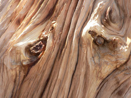
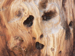
I am fascinated by the gnarled bark and the variety of body types of Bristlecone Pine trees. The colors, textures and forms send my imagination into overdrive. I see faces in the trees, and then animals, and then some sensual images. I photo each detail while Bill tries to keep me on track with the facts from the self-guided brochures. I love this hike.
We stop back at the Ranger’s Station so Bill can find out if a guy he used to work with really killed the oldest living thing in the world (a 5,000 year old Bristlecone Pine) while he was a graduate student in the 60’s. The Ranger says something politically correct “a tree was taken . . . there was some bad judgment and broken equipment . . .but . . . “ So, it’s true. Bill’s friend regrets his part in the murder.
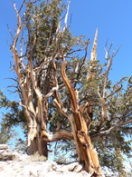
We drive 12 miles up a windy, dirt road to the Patriarch Grove, the Bristlecone Pines that dwell higher up on the top of the mountain. Here we see more picturesque pines, the kind whose photos make it into coffee table books. These granddaddy’s are easier to photograph as they twist into the bright blue sky. One is over 36 feet around. (See trail map and more photos of this hike.)
Patriarch Grove |
Patriarch Grove |
Patriarch Grove |
A baby |
Patriarch Grove |
Patriarch Grove |
About 3:00, we grab some energy snacks – cokes, Fritos, chocolate bars and cheese and then leave the high forest.
We drive back down the windy road. The shadows are perfect on the trees and mountains, but I spent too much time taking pictures and we need to get back to civilization and find a motel.
We head south on 395 toward Lone Pine, the gateway to Mt. Whitney, the highest peak in the lower ’48. The drive is beautiful with very little traffic. Then we arrive in Lone Pine about 6:30. The main road is under serious construction. Traffic is backed up. The town is loaded with people and tour buses and the motels are filling up fast. We are shocked by the $95 / night sticker price for a little budget motel and drive down the road hoping for better. The next spot is $85. We just want to settle in and have a beer so The Portal is home sweet home. We clean up and walk a few blocks into town looking for a nice dinner. We find it at The Totem Café. We ate there a couple of years ago and didn’t remember being repulsed. We are happy with our shared half roasted chicken with salad and potato. We study the old photos on the wall while we wait for our check … then it’s back to The Portal to journal and catch up on emails.
9/18/09 – Lone Pine to Death Valley
We eat a so-so breakfast at the High Sierra Café right across the street from our motel.
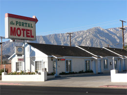
The Portal Motel, Lone Pine |
Our not-so-good-breakfast cafe |
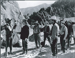
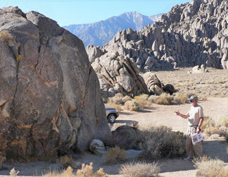
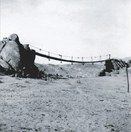
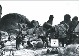
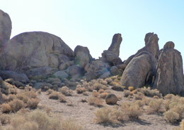
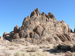
We gather our stuff and head for the Alabama Hills, named by Confederate sympathizers in honor the Confederate ship, Alabama, which sank over 50 Union ships in under 2 years. The Alabama Hills are famous now because of the movie industry. In 1920, Fatty Arbuckle came here to make the silent film, “The Round Up,” for Paramount. Since then, more than 300 feature films have been shot in these here hills along with dozens of TV shows and commercials. In fact, I remember some of these scenes in the 1950’s when I watched my heroes in black and white -- Gene Autry, Hopalong Cassidy, Roy Rodgers, The Lone Ranger and The Cisco Kid – ride across the hills chasing the guys in black hats.
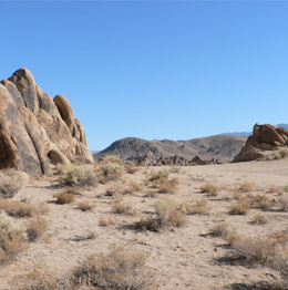
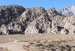
Armed with a self-guided tour map Bill downloaded from the Internet along with specific GPS points, we drive through “Movie Flat.” We feel like we’re on a giant treasure hunt -- it’s a fun tour. There are no paved roads, just jeep tracks used to transport actors, directors, crew, props and equipment “once upon a time” long ago when this place was a hot spot for movie production. We weave in and out of the weird picturesque rock formations with the majestic High Sierra as the backdrop.
Guided by photos (from different movies) and specific GPS points, we scurry about finding the location of scenes from famous movies such as:
- Gunga Din (1939 – stand-in for India with the Sierras posing as the Himalayas);
- Showdown (1963 with Audie Murphy);
- Rawhide (1951 with Tyrone Power and Susan Hayward);
- The Gay Caballero (1940 – Cesar Romero plays the Cisco Kid),
- The Tall T (1957 with Randolph Scott);
- How the West Was Won (1962, directed by John Ford) and
- Hell Bent for Leather (1960 Audie Murphy and Felicia Farr).
We get out of the car and look for just the right camera angle and placement. We view the damage to large boulders done by the set designers when they created a bridge in Gunga Din. Bill finds a rusty old cigarette holder, perhaps dropped by some crew member decades ago. I could spend hours looking for the ghosts of John Wayne, Randolph Scott and other famous pretend cowboys. In the following photos, all movie photos are from "In the Alabama Hills, Movie Road Self Guided Tour" published by the Beverly and Jim Rogers Museum.
We are intrigued and want to know more. We drive back to Lone Pine to visit “The Beverly and Jim Rogers Museum of Lone Pine Film History” on Main Street. The museum is very well done and the 15-minute orientation video is excellent. We learn that other, non-western films were shot here: “Tremors,” “The Iron Man,” “Brigham Young,” and “The Treasure of the Sierra Madre.” This is our kind of spot.
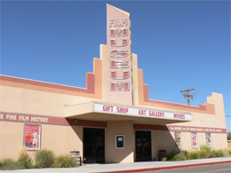
Beverly and Jim Rogers Museum |
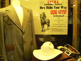
Display inside the museum |
After the museum, we drive down to a greasy spoon on a side street, recommended by the gal in the movie museum. It’s the real deal – only the locals find their way here. Life has not been kind to the waitress and the cook (I assume the waitress’s mother). The 5 year old son / grandson is misbehaving at the barstool. The mother / waitress continues to threaten him while the grandmother / cook admonishes the daughter – “Don’t you remember what it was like when you were 5 years old?” I am starving and manage to block out the scene. Although it’s only 11, I order a burger and fries. Bill orders the senior’s half sandwich and soup, but he is so full, he can’t eat the sandwich.
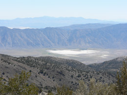
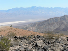
We drive south on 395 and take 136 east to Cerro Gordo Mines, located at 8,500 feet in the Inyo Mountains. The route is fascinating. We see Owens Lake (now almost empty) and the remains of a once booming mining industry in the 1870 – 80’s.
Owens Lake seems to dominate our trip. In 1845, explorer John C. Fremont named the river, lake and valley after his friend and fellow explorer, Richard Owens. At that time, Owens Lake had a surface area of 110 square miles, although it was shallow and saline.
Owens Lake played a critical role in the mining days. During the 1870’s, two steamers hauled silver bullion from smelters on the northeast shore to freight wagons waiting on the western shore and on their return trip, brought charcoal for the smelter fires—quite an operation. It’s difficult to image all the commerce and activity in this now seemingly dead, dried up area.
Along the route we look for the white tailings of the Dolomite Mine. In the 1890’s, the local people called it “Mountain of Marble” and sculptors and architects prized the pure white stone. Farther down the route, at the foot of the mountains, we see what’s left of the salt tram that carried salt across the Inyos from the Saline Valley on the other side.
We drive through two little towns – Swansea, named for a Welsh coastal town and Keeler. Swansea was the site of a furnace built in 1869 to process Cerro Gordo ore. Keeler was named for the mine operator who planned the town. Keeler was also located at the southern part of the Carson and Colorado narrow gauge railroad. However the railroad never did link Carson City with the Colorado River as promised. When it reached Keeler in 1883, most of the local mines were kaput – the dreams were gone and the people moved on to new dreams.
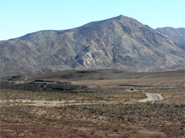
Past Keeler, we turn left and head up a graded dirt road into the Inyo Mountains. There is a plaque at the side of the road. We get our first big ah-ha as we learn about Cerro Gordo – the main focus of our adventure. Located at 8,500 feet in the Inyo Mountains, Cerro Gordo (Fat Hill) was discovered, named and developed by Mexican prospectors who found silver, lead, and zinc in the mid-1860’s. By 1865, the mineral business was worth $17,000,000.
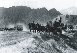
Cerro Gordo was a boomtown where gunfights, murders, dance halls, saloons and red-light houses were a regular occurrence. During Cerro Gordo’s heyday in the 1870’s and early 80’s, silver ore and bullion made its way down the steep toll road (Yellow Grade) and to the ports of Swansea and Keeler, along the then-full Owens Lake. The ingots were loaded onto steamships (Bessie Brady and Molly Stevens) and shipped across the lake to Cartago. (On the return trip, the steamships carried lumber and charcoal from Col. Serman Steven’s sawmill and kilns.) Meanwhile, at Cartago, the silver was loaded onto huge wagons driven by the master teamster Remi Nadeau. Nadeau’s mule teams (of 20 mule team fame) carried the silver bullion 200 miles south to a small pueblo and its port at San Pedro to be shipped to San Francisco for final refining. In 1870 alone, over 700 tons of bullion rolled south from Cerro Gordo’s mines. The mule team wagons returned to Cerro Gordo loaded with goods and produce. The continuing steam of wealth brought prosperity to the struggling “El Pueblo” transforming it into the city of Los Angeles. By 1888, Cerro Gordo was almost gone. Limited mining went on into the early 20 th century. Thanks to Cerro Gordo, we have L. A. and the thriving port of San Pedro.
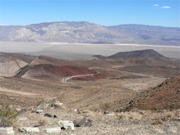
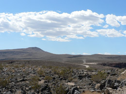
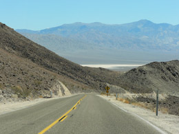
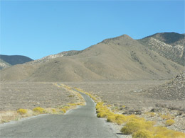
The present day town site of Cerro Gordo is private property. To tour Cerro Gordo you need to call ahead to make arrangements. Unfortunately for us the phone number we had was not correct and we were not able to contact the owner. Undeterred we decided to attempt the dirt road that climbs 5000 feet in 7.5 miles. About 2 miles from the top, when our tires started the spin, we said, “Oh well – maybe some other time.” One day, I hope to see the once glorious town. We turn back at a wide section on the vertical road. We continue south on 136 and after a few miles, we connect with 190, which will take us into Death Valley (or the valley of death).
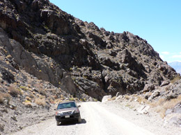
Road to Cerro Gordo |
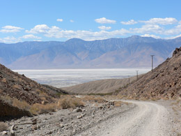
Road to Cerro Gordo |
After miles of driving in wide-open spaces, we turn right at Panamint Valley Road and enter Death Valley National Park. We stop at Father Crowley Point. Father John J. Crowley (1901 – 1940) must have been a sweet Padre. Here’s what the plaque said about him:
In Memory of The Padre of the Desert. Father John J. Crowley
From the snowy heights of the Sierras beyond the deep shadows of Death Valley, beloved and trusted by people of all faiths. He led them toward life’s wider horizons. He passed this way.
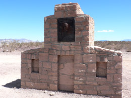
Father John Crowley Monument
|
Death Valley |
Death Valley |
Death Valley |
Death Valley |
Death Valley |
Next we stop in Panamint Springs, a little town way out in no man’s land with a restaurant and motel. It was originally built in 1937 by William Reid, who was a foreman for a talc mine located near Darwin and his wife Agnes Cody Reid, who was a cousin of William “Buffalo Bill Cody. Agnes continued to operate the resort after Bill’s death in 1945. It was sold in 1959. In 1992, the 40-acre resort was developed to include a restaurant, bar and 15-unit motel, a gas station and a convenience store. It looks pretty decent. For a few minutes, I get my hopes up -- maybe we won’t have to camp in a primitive campground without water or toilets. Unfortunately, all that is available is the expensive 3-bedroom cabin. (The $79 rooms were probably taken by visiting Germans.)
What is this? |
What could this be? |
We head on to Emigrant Canyon Road (which wasn’t marked), over Emigrant Pass and down to Wildrose Campground where the paved road turns to dirt.
Death Valley |
Death Valley |
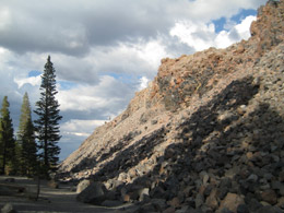
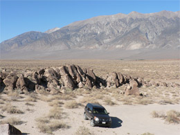
We stop after a few miles to check out the Charcoal kilns. We see 10 huge beehive structures. We learn that they were designed by Swiss engineers and built by Chinese laborers in 1879. They were used to produce charcoal for the Madock Mine smelter, about 20 miles west of here.
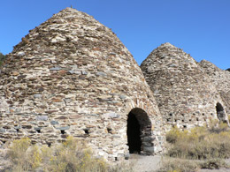
The Kilns |
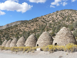
The Kilns |
Workers filled the airtight kilns with pinyon pine logs, abundant in this area. It took 6 to 8 days to burn the logs and reduce them to charcoal. After another 5 days of cooling, wagons hauled the charcoal to Madock Mine smelter to extract silver and lead from the rich ore.
The kilns closed after only three years of use. Because of their limited usage and remote location, they are very well preserved. Until now, I had no idea how kilns and charcoal production played a role in the mining operation – that’s why I love traveling.
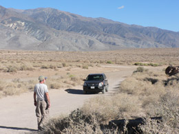
The road for the next two miles, to Mahogany Flat Campground, is rough, steep and slow going. We’re afraid we might have a blow out. We see no one for miles. We remember that NO ONE in the world knows we’re in Death Valley. The “what if’s” start pouring out. What if we’ll have a medical emergency (e.g., my heart) with no way to get treatment? What if one of us falls? What if there’s a mass murderer? We never use to be consumed with “What If’s” . . . but age does things to you.
We finally arrive at our campsite, Mahogany Flat ( elevation 8133 feet – primitive camping – 10 picnic tables scattered about and one small, smelly pit ). No one is in sight. We see one truck in the parking lot with a Nevada license plate. We are still nervous and discuss whether or not we should stay. In no time, we are calmed by the beauty and peacefulness of the place.
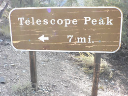
We drive through the campsite and discover a few other campers. We find a suitable spot. I dash off to check out the trailhead to Telescope Peak – climbing to the top is the whole purpose of our adventure. The trail looks so inviting. We decide not to give in to our fears and go for it. We lay claim to a picnic table and Bill puts up the tent. I drink a beer and do my journal.
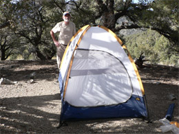
Our accommodations at Mahogany Flat |
View from Mahogany Flat |
trailhead |
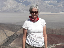
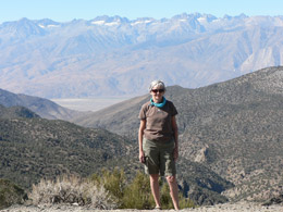
Death Valley (with Nancy blocking the view) |
As it’s getting dark, Bill makes dinner – a can of beef stew – barfy. I eat extra bread and butter and have a second glass of wine. We organize our backpacks for tomorrow’s hike while there is still light.
We retreat into our tent about 8:30 when it is completely dark. We blind each other with our petzls (personal headlights) and then manage to break the zipper to our tent. The air mattress is swishy. We read our books, lying as still as possible so we won’t disturb each other. I learn all about Death Valley. I pop a sleeping pill about 9:30 just as the wind is kicking up. I sleep through the night (with my sleep aid) while Bill tosses and turns. (I’m glad I got some rest and I’m very glad the wind didn’t blow our tent away.)
9/19/09 – Death Valley – Climb to Telescope Peak
We awake about 6:00, eat some cereal and bread washed down with coffee / tea and the last of our orange juice.
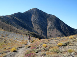
We start our hike to Telescope Peak (11,049 feet) 7:35. It’s a steep, strenuous, 14-mile round-trip hike, gaining over 3,000 feet in altitude. The hike begins in the arid woodlands of juniper and pinyon pine. The iffy shade doesn’t last long as the trail takes us higher and higher and over a meadow. We are awestruck by the vast beauty. Luckily, the weather is kind (about 75 – 80 degrees) and the breeze is gentle. It can be brutally hot or brutally cold out here.
We soon emerge onto the open eastern slope of Rogers Peak. Below us to the east, we see the vast basin of Death Valley, looking over the dry salt flats of Badwater, the lowest point in the western hemisphere at 282 below sea level.
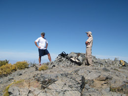
A friendly, unassuming guy named Joe stops to greet us. It turns out he is an animal who lives to do super human feats on his weekends. He even was part of a 4-man team that rode the Race Across America – crossed the US in 7 days on a bike.
In the first two and a half miles of the hike, we gain 1500 feet. We pass a broad saddle, and then reach a mountain meadow (Arcane Meadows) with Rogers and Bennett Peaks as the backdrop. The trail flattens out a bit, giving us some relief from the constant uphill. The ridge trail gives us wide-angle views of the wide-open spaces. Of course, we stop for photos. The trail drops us onto the east side of a broad ridge separating Telescope and Bennett Peaks. We forge ahead on the serene passage along the meadow ridge.
We cross the mile-long ridge and begin the steep final ascent to the summit – and I mean steep. To this point, the trail is a relatively easy -- eight percent grade -- but now we struggle to continue. The meadow changes into gnarled ancient Bristlecone pines as the switchbacks become more severe.
One final switchback and we reach the main summit ridge. We see the summit only about a hundred yards away. I start to feel really buff. What a welcome sight!
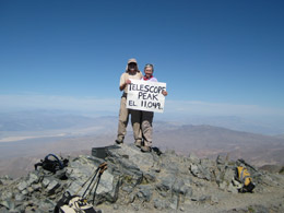
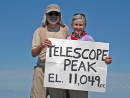
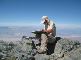
High 5 - we did it! We see Joe at the summit, relaxing and reading the registration log. Bill checks his GPS, then Joe takes our photo. We eat our lunch and then we share our Fritos and cheese with Joe.
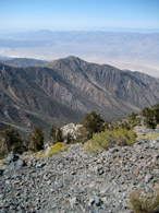
It is a gorgeous day. From the summit of Telescope Peak, we have a 360º view of the surrounding basins and mountains. Death Valley is before us and to the east, a vast panorama. To the northwest, beyond the Inyo Mountains, is the Sierra Nevada Mountains. We find Mount Whitey, tucked among the many snow caped peaks. It appears smaller – but we know better. To the west, we see Panamint Valley, China Lake and the Coso Range.
Just as we are packing up, a group of four Asian students from L.A. make the summit. They are dying and surprised to find an old lady like me relaxing at the top. We take their traditional “we made it” group shot and then hoist our packs on and head back down the seven-mile trail back to camp. (Joe is off to bag another peak – Rogers'’s Peak before his day of killer hiking is over.)
I listen to my headphones and groove to the African beats. Before we know it, we’re back at the campground. Bill signs out on the trailhead. registry at 2:30 pm. With lunch and photo stops, it only took 7 hours to do Telescope Peak. (See trail map and more photos of this hike.)
Telescope Peak Trail |
Telescope Peak Trail |
Telescope Peak Trail |
Telescope Peak Trail |
Telescope Peak Trail |
Telescope Peak Trail |
Telescope Peak Trail |
Telescope Peak Trail |
Telescope Peak Trail |
Right before we leave, Joe appears and we have a celebratory beer. Bill drinks a coke because he’s facing a 6 or 7-hour drive home.
We make it down the washed out road and then negotiate another stretch of unpaved road before we get to the main roads. We take 178 south and drive through the sad sack city of Trona. It’s industrial and polluted and covered with a white dust. They mine borax here (and have for years) to put in detergent. It’s ironic that the dirtiest little town was put on the map because of detergent!
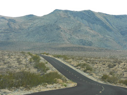
The road home |
After some almost missed turns, we connect with 395 and get closer to civilization. We stop at Kramer Junction for gas and a burger (at the Roadhouse Restaurant where we started the trip).
395 is tedious with only 2 lanes. We are glad to connect with I-15 – but that is tedious too and going down the chute through the San Bernardino Mountains really gets ones’ attention.
We arrive home at 8:30 p.m., safe (and maybe not so sound). It’s good to be home.
|